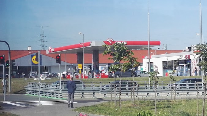
Gas station nearby Gas station Q12
Coronavirus disease (COVID-19) Situation
confirmed cases
6661991
deaths
120598
Poland
Gas station nearby Gas station Q12
Gas station Q12
129, Kolonia Strzalkow, Strzałków 26-625 Polonia
contacts phone
:
+48
Latitude:
51.3736293
, Longitude:
20.9276244
read more
nearest Gas station
1.848 km
Stacja paliw Strzałków
Nowe Strzałki 26
Gas station
read more
3.549 km
Prywatna Wolanów
Radomska 2, Wolanów
Gas station
read more
4.007 km
BP
Radomska 32
Gas station
read more
4.02 km
BP
Klasztorna 32, Wolanów
Gas station
read more
4.028 km
Stacja paliw BP
Wolanów
Gas station
read more
8.551 km
Stacja LPG - Orońsko
Orońsko, Dobrut 18 B
Gas station
read more
8.579 km
Lukoil
Dobrut
Gas station
read more
13.7 km
Stacja Paliw ORLEN
Kielecka 22/24, Radom
Gas station
read more
13.797 km
Parking strzeżony całodobowy
Dębowa 25, Radom
Gas station
read more
13.872 km
PW MERA
Bolesława Limanowskiego 75/73, Radom
Gas station
read more
13.882 km
Poczta P
Wierzbicka 80C, Radom
Gas station
read more
13.883 km
Gas station E. Leclerc
Centrum Handlowe E. Leclerc, 620, Toruńska 1, Radom
Gas station
read more
13.961 km
Kastor. Stacja paliw
Wierzbicka 146, Radom
Gas station
read more
14.027 km
BP
Kielecka 5, Radom
Gas station
read more
14.155 km
Stacja Paliw Miejskiego Przedsiębiorstwa Komunikacji Sp. z o.o.
Wjazdowa 4, Radom
Gas station
read more
14.203 km
Prywatna
Trablice 73A
Gas station
read more
14.4 km
Lotos
1905 Roku 47, Radom
Gas station
read more
14.766 km
Circle K Express
Stefana Czarnieckiego 45, Radom
Gas station
read more
14.785 km
Circle K Radom
Stefana Czarnieckiego 45, Radom
Gas station
read more
15.029 km
Stacja Paliw ORLEN
1905 Roku 24, Radom
Gas station
read more
15.052 km
transOil tanie paliwo
Bolesława Limanowskiego 26/30, Radom
Gas station
read more
15.263 km
Circle K
Stefana Czarnieckiego 73, Radom
Gas station
read more
16.765 km
Huzar
Bród 13, Gutów
Gas station
read more
18.073 km
Lotos
Warszawska 81, Wielogóra
Gas station
read more
18.253 km
BP
Warszawska 41, Jedlińsk
Gas station
read more
📑
all categories
Accounting
Administrative area level 1
Administrative area level 2
Airport
Amusement park
Aquarium
Art gallery
Atm
Bakery
Bank
Bar
Beauty salon
Bicycle store
Book store
Bowling alley
Bus station
Cafe
Campground
Car dealer
Car rental
Car repair
Car wash
Casino
Cemetery
Church
City hall
Clothing store
Colloquial area
Convenience store
Courthouse
Dentist
Department store
Doctor
Electrician
Electronics store
Embassy
Finance
Fire station
Florist
Food
Funeral home
Furniture store
Gas station
General contractor
Grocery or supermarket
Gym
Hair care
Hardware store
Health
Hindu Temple
Home goods store
Hospital
Insurance agency
Intersection
Jewelry store
Laundry
Lawyer
Library
Light rail station
Liquor store
Local government office
Locality
Locksmith
Lodging
Meal delivery
Meal takeaway
Mosque
Movie rental
Movie theater
Moving company
Museum
Natural feature
Neighborhood
Night club
Painter
Park
Parking
Pet store
Pharmacy
Physiotherapist
Place of worship
Plumber
Point of interest
Police
Political
Post office
Premise
Real estate agency
Restaurant
Roofing contractor
Route
Rv park, camping
School
Shoe store
Shopping mall
Spa
Stadium
Storage
Store
Subpremise
Subway station
Supermarket
Synagogue
Taxi stand
Train station
Transit station
Travel agency
University
Veterinary care
Zoo
administrative area level 3
sublocality level 1
↑