Pharmacy nearby Spectrum s.c.
Poland
Pharmacy nearby Spectrum s.c.
Spectrum s.c.
12, Naruszewicza, 93-161, Łódź, Łódź, PL Polska
contacts phone
:
+48 42 648 35 64
Latitude:
51.7312703
, Longitude:
19.4800432
larger map & directions
read more
nearest Pharmacy
202 m
Safora s.c. Apteka. Błaszczak-Świątkiewicz K.
Mazurska 21, Łódź
Pharmacy
read more
313 m
Promyk
Broniewskiego 2, Łódź
Pharmacy
read more
319 m
Kraina Leków
Jana Kilińskiego 300, Łódź
Pharmacy
read more
347 m
Joga
Mochnackiego 1/3, Łódź
Pharmacy
read more
389 m
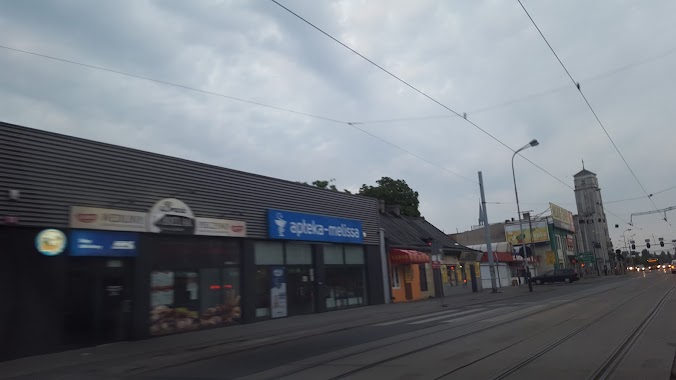
Apteka Melissa
Rzgowska 76, Łódź
Pharmacy
read more
410 m
Zielone Wzgórze
Jana Kilińskiego 298, Łódź
Pharmacy
read more
478 m
Eurovission
Rzgowska 63, Łódź
Pharmacy
read more
484 m
Terapia
Niemcewicza 17, Łódź
Pharmacy
read more
521 m
Apteka Magiczna
Łączna 28, Łódź
Pharmacy
read more
525 m
Apteka Gwiazda 2
Broniewskiego 38, Łódź
Pharmacy
read more
553 m
Apteka Cef@rm 36,6
93-160, Jana Kilińskiego 296, Łódź
Pharmacy
read more
627 m
Dar Zdrowia
Rzgowska 51, Łódź
Pharmacy
read more
642 m
Zioła Polskie
Lecznicza 4, Łódź
Pharmacy
read more
654 m
DOZ Apteka dbam o zdrowie
Lecznicza 4, Łódź
Pharmacy
read more
776 m
DOZ Apteka dbam o zdrowie
Paderewskiego 47, Łódź
Pharmacy
read more
798 m
DOZ Apteka dbam o zdrowie Szymonowica
Szymonowica 22, Łódź
Pharmacy
read more
802 m
Apteka Zdrowit
Dąbrowskiego 15b, Łódź
Pharmacy
read more
814 m
Apteka
93-020, Tuszyńska 26, Łódź
Pharmacy
read more
851 m
DOZ Apteka dbam o zdrowie Twoja
Broniewskiego 65, Łódź
Pharmacy
read more
866 m
Apteka Zielone Wzgórze
Rzgowska 50A, Łódź
Pharmacy
read more
895 m
Gwiazda
Broniewskiego 67, Łódź
Pharmacy
read more
897 m
Apteka Zdrowit
Dąbrowskiego 63,90-001, Łódź
Pharmacy
read more
1.137 km
Apteka Remedium
Dąbrowskiego 89, Łódź
Pharmacy
read more
1.143 km
Apteka A.S.Rybowscy Grupa APSPEC
Rodakowskiego 1, Łódź
Pharmacy
read more
1.752 km
Apteka Sieciowa
Piotrkowska 307, Łódź
Pharmacy
read more
📑
all categories
Accounting
Administrative area level 1
Administrative area level 2
Airport
Amusement park
Aquarium
Art gallery
Atm
Bakery
Bank
Bar
Beauty salon
Bicycle store
Book store
Bowling alley
Bus station
Cafe
Campground
Car dealer
Car rental
Car repair
Car wash
Casino
Cemetery
Church
City hall
Clothing store
Colloquial area
Convenience store
Courthouse
Dentist
Department store
Doctor
Electrician
Electronics store
Embassy
Finance
Fire station
Florist
Food
Funeral home
Furniture store
Gas station
General contractor
Grocery or supermarket
Gym
Hair care
Hardware store
Health
Hindu Temple
Home goods store
Hospital
Insurance agency
Intersection
Jewelry store
Laundry
Lawyer
Library
Light rail station
Liquor store
Local government office
Locality
Locksmith
Lodging
Meal delivery
Meal takeaway
Mosque
Movie rental
Movie theater
Moving company
Museum
Natural feature
Neighborhood
Night club
Painter
Park
Parking
Pet store
Pharmacy
Physiotherapist
Place of worship
Plumber
Point of interest
Police
Political
Post office
Premise
Real estate agency
Restaurant
Roofing contractor
Route
Rv park, camping
School
Shoe store
Shopping mall
Spa
Stadium
Storage
Store
Subpremise
Subway station
Supermarket
Synagogue
Taxi stand
Train station
Transit station
Travel agency
University
Veterinary care
Zoo
administrative area level 3
sublocality level 1
↑