Pharmacy nearby Pharmacy 36.6 Cefarm
Poland
Pharmacy nearby Pharmacy 36.6 Cefarm
Pharmacy 36.6 Cefarm
Rozłogi 10, Warszawa Polen
contacts phone
:
+48
Latitude:
52.2239694
, Longitude:
20.900416
read more
nearest Pharmacy
Apteka Cef@rm 36,6
Rozłogi 10, Warszawa
Pharmacy
read more
643 m
Apteka MIRO
Kazimierza Wyki 11, Warszawa
Pharmacy
read more
697 m
Apteka Cosmedica
Lazurowa 69/1, Warszawa
Pharmacy
read more
864 m
Apteka Borowej Góry
Borowej Góry 8, Warszawa
Pharmacy
read more
882 m
Apteka Miejska przy Kauflandzie
Batalionów Chłopskich 73, Warszawa
Pharmacy
read more
913 m
Apteka Giełda Zdrowia
Świetlików 8, Warszawa
Pharmacy
read more
917 m
Preibisch Małgorzata. Apteka sp.j.
Sucharskiego 8, Warszawa
Pharmacy
read more
940 m
Apteka Syrenka
Świetlików 8, Warszawa
Pharmacy
read more
1.081 km
Euro-Apteka
Powstańców Śląskich 19, Warszawa
Pharmacy
read more
1.115 km
Apteka
Legendy 10, Warszawa
Pharmacy
read more
1.127 km
Apteka Hibiskus
Powstańców Śląskich 45, Warszawa
Pharmacy
read more
1.161 km
Apteka Cefarm 36,6
Powstańców Śląskich 10, Warszawa
Pharmacy
read more
1.171 km
Apteka Cef@rm 36,6
Powstańców Śląskich 10, Warszawa
Pharmacy
read more
1.216 km
Apteka Bona Vita
Powstańców Śląskich 30, Warszawa
Pharmacy
read more
1.496 km
EURO-APTEKA Sp. z o.o.
Połczyńska 121/125, Warszawa
Pharmacy
read more
1.565 km
Euro-Apteka
Połczyńska 121/125, Warszawa
Pharmacy
read more
1.688 km
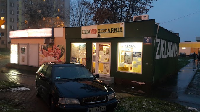
ZielaMed
Warsaw
Pharmacy
read more
1.688 km
ZielaMed
Warszawa
Pharmacy
read more
1.688 km
ZielaMed
ul, Czumy 1A, Warszawa
Pharmacy
read more
1.693 km
Kamińska-Bała Krystyna, mgr farm. Apteka
Waleriana Czumy 3A, Warszawa
Pharmacy
read more
1.824 km
Apteka Włochy
Globusowa 25, Warszawa
Pharmacy
read more
1.827 km
Dr. Max pharmacy
Górczewska 218, Warszawa
Pharmacy
read more
2.131 km
Pharmacy. prescription drugs
Bolkowska 2A, Warszawa
Pharmacy
read more
2.156 km
Apteka Zdrowie
Świerszcza 2, Warszawa
Pharmacy
read more
2.798 km
Super-Pharm
CH Wola Park, Górczewska 124, Warszawa
Pharmacy
read more
📑
all categories
Accounting
Administrative area level 1
Administrative area level 2
Airport
Amusement park
Aquarium
Art gallery
Atm
Bakery
Bank
Bar
Beauty salon
Bicycle store
Book store
Bowling alley
Bus station
Cafe
Campground
Car dealer
Car rental
Car repair
Car wash
Casino
Cemetery
Church
City hall
Clothing store
Colloquial area
Convenience store
Courthouse
Dentist
Department store
Doctor
Electrician
Electronics store
Embassy
Finance
Fire station
Florist
Food
Funeral home
Furniture store
Gas station
General contractor
Grocery or supermarket
Gym
Hair care
Hardware store
Health
Hindu Temple
Home goods store
Hospital
Insurance agency
Intersection
Jewelry store
Laundry
Lawyer
Library
Light rail station
Liquor store
Local government office
Locality
Locksmith
Lodging
Meal delivery
Meal takeaway
Mosque
Movie rental
Movie theater
Moving company
Museum
Natural feature
Neighborhood
Night club
Painter
Park
Parking
Pet store
Pharmacy
Physiotherapist
Place of worship
Plumber
Point of interest
Police
Political
Post office
Premise
Real estate agency
Restaurant
Roofing contractor
Route
Rv park, camping
School
Shoe store
Shopping mall
Spa
Stadium
Storage
Store
Subpremise
Subway station
Supermarket
Synagogue
Taxi stand
Train station
Transit station
Travel agency
University
Veterinary care
Zoo
administrative area level 3
sublocality level 1
↑