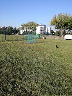
Park nearby Osówka
Poland
Park nearby Osówka
Osówka
42-500 Będzin, Polska
contacts phone
:
+48
Latitude:
50.3335101
, Longitude:
19.0975409
larger map & directions
read more
nearest Park
1.103 km
Strefa psiej aktywności
Bursztynowa 17, Będzin
Park
read more
1.375 km
Park Ciechanowskich
Będzin
Park
read more
1.888 km
Psi Park
Bursztynowa, Będzin
Park
read more
1.895 km
Park Mieroszewskich
Gzichowska, Będzin
Park
read more
1.989 km
Park Rozkówka
Będzin
Park
read more
1.998 km
Park Dolna Syberka
Będzin
Park
read more
2.021 km
park Syberka
Małobądzka 2, Będzin
Park
read more
2.021 km
Park Lower Syberka
Małobądzka 2, Będzin
Park
read more
2.043 km
Park Na Syberce
Będzin
Park
read more
2.059 km
Ogródki działkowe
Wojkowicka 35, Czeladź
Park
read more
2.085 km
Las Grodziecki
Będzin
Park
read more
2.282 km
Zapłocie Aleja Rodów Czeladzkich
Bolesława Pieńkowskiego, Czeladź
Park
read more
2.371 km
Fontanna
Rynek Imienia Stefana Wyszyńskiego - Prymasa Polski 41-250, Czeladź
Park
read more
2.517 km
ROD Wypoczynek
Unnamed Road
Park
read more
2.544 km
Wzgórze zamkowe
Góra Zamkowa 9, Będzin
Park
read more
2.569 km
Ogródki działkowe Będzin - Syberka
Będzin
Park
read more
2.772 km
Park Harcerski Kamionka
Unnamed Road
Park
read more
2.792 km
Park im. T. Kościuszki
Czeladz
Park
read more
2.835 km
Park Małpi Gaj
Unnamed Road
Park
read more
2.846 km
Park Prochownia
Nowopogońska, Czeladź
Park
read more
3.084 km
Stawiki
Letnia, Czeladź
Park
read more
3.267 km
Park Grabek
Legionów 149D, Czeladź
Park
read more
4.624 km
Park Mini
Staropogońska 75, Sosnowiec
Park
read more
5.225 km
Dinosaurierpark
Siemianowice Slaskie
Park
read more
6.69 km
Ogrodzony wybieg dla psów
3 Maja, Sosnowiec
Park
read more
📑
all categories
Accounting
Administrative area level 1
Administrative area level 2
Airport
Amusement park
Aquarium
Art gallery
Atm
Bakery
Bank
Bar
Beauty salon
Bicycle store
Book store
Bowling alley
Bus station
Cafe
Campground
Car dealer
Car rental
Car repair
Car wash
Casino
Cemetery
Church
City hall
Clothing store
Colloquial area
Convenience store
Courthouse
Dentist
Department store
Doctor
Electrician
Electronics store
Embassy
Finance
Fire station
Florist
Food
Funeral home
Furniture store
Gas station
General contractor
Grocery or supermarket
Gym
Hair care
Hardware store
Health
Hindu Temple
Home goods store
Hospital
Insurance agency
Intersection
Jewelry store
Laundry
Lawyer
Library
Light rail station
Liquor store
Local government office
Locality
Locksmith
Lodging
Meal delivery
Meal takeaway
Mosque
Movie rental
Movie theater
Moving company
Museum
Natural feature
Neighborhood
Night club
Painter
Park
Parking
Pet store
Pharmacy
Physiotherapist
Place of worship
Plumber
Point of interest
Police
Political
Post office
Premise
Real estate agency
Restaurant
Roofing contractor
Route
Rv park, camping
School
Shoe store
Shopping mall
Spa
Stadium
Storage
Store
Subpremise
Subway station
Supermarket
Synagogue
Taxi stand
Train station
Transit station
Travel agency
University
Veterinary care
Zoo
administrative area level 3
sublocality level 1
↑