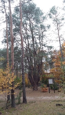
Park nearby Czarne Jeziorka
Poland
Park nearby Czarne Jeziorka
Czarne Jeziorka
05-480 Karczew, Poland
contacts phone
:
+48
Latitude:
52.0610014
, Longitude:
21.2975696
larger map & directions
read more
nearest Park
522 m
Lisie Górki
Karczew
Park
read more
1.506 km
Rezerwat przyrody Na Torfach
Karczew
Park
read more
2.054 km
Obserwacja ciemnego nieba
Unnamed Road, Karczew
Park
read more
2.296 km
Mazowiecki Park Krajobrazowy
Otwock
Park
read more
2.296 km
Mazowiecki Landscape Park
Otwock
Park
read more
2.496 km
Lasy Otwockie
Karczew
Park
read more
2.791 km
Sosna Bożenna
Gen. Bema 52, Otwock
Park
read more
3.622 km
głaz narzutowy
Poland
Park
read more
3.81 km
P.W. NAWONEXIM OpiekunOgrodu.pl
Krzysztofa Kamila Baczyńskiego 5, Karczew
Park
read more
4.059 km
Siłownia Plenerowa
Marszałka Józefa Piłsudskiego 35, Karczew
Park
read more
4.434 km
Dęby szypułkowe
Lasek 44A, Lasek
Park
read more
4.58 km
Park Miejski
Generała Juliana Filipowicza 9, Otwock
Park
read more
4.593 km
Fontanna
Otwock
Park
read more
4.616 km
Mazowiecki Las Grobla
Mazowiecki Park Krajobrazowy, Warszawska 56, Otwock
Park
read more
4.651 km
Otwock Nocą
Jana Matejki 8, Otwock
Park
read more
4.689 km
Rezerwat Pogorzelski Mszar
Otwocka 25, Pogorzel
Park
read more
5.25 km
Skwer Szarych Szeregów
Hoża 2, Otwock
Park
read more
5.795 km
Park
Park, Glinki
Park
read more
5.9 km
Exclusive Garden
Wałbrzyska 2, Warszawa
Park
read more
6.551 km
Łachy Brzeskie
Kalwaryjska, Góra Kalwaria
Park
read more
8.843 km
Góry Grudeckie
Poland
Park
read more
9.855 km
most i tama
Doliny Świdra, Wola Karczewska
Park
read more
12.337 km
Dwa mostki
Unnamed Road, Konstancin-Jeziorna
Park
read more
17.096 km
Łąka Zalewowa Na Warszawskim Odcinku OSOP Natura 2000
00-001, Warszawa
Park
read more
18.558 km
Plac Miejski w Wilanowie
Wilanów
Park
read more
📑
all categories
Accounting
Administrative area level 1
Administrative area level 2
Airport
Amusement park
Aquarium
Art gallery
Atm
Bakery
Bank
Bar
Beauty salon
Bicycle store
Book store
Bowling alley
Bus station
Cafe
Campground
Car dealer
Car rental
Car repair
Car wash
Casino
Cemetery
Church
City hall
Clothing store
Colloquial area
Convenience store
Courthouse
Dentist
Department store
Doctor
Electrician
Electronics store
Embassy
Finance
Fire station
Florist
Food
Funeral home
Furniture store
Gas station
General contractor
Grocery or supermarket
Gym
Hair care
Hardware store
Health
Hindu Temple
Home goods store
Hospital
Insurance agency
Intersection
Jewelry store
Laundry
Lawyer
Library
Light rail station
Liquor store
Local government office
Locality
Locksmith
Lodging
Meal delivery
Meal takeaway
Mosque
Movie rental
Movie theater
Moving company
Museum
Natural feature
Neighborhood
Night club
Painter
Park
Parking
Pet store
Pharmacy
Physiotherapist
Place of worship
Plumber
Point of interest
Police
Political
Post office
Premise
Real estate agency
Restaurant
Roofing contractor
Route
Rv park, camping
School
Shoe store
Shopping mall
Spa
Stadium
Storage
Store
Subpremise
Subway station
Supermarket
Synagogue
Taxi stand
Train station
Transit station
Travel agency
University
Veterinary care
Zoo
administrative area level 3
sublocality level 1
↑