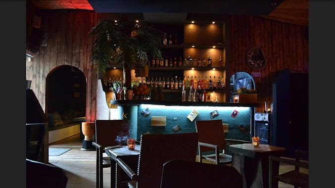
Night club nearby Hades
Poland
Night club nearby Hades
Hades
32, Podleśna, 80-001, Gdańsk, Gdańsk, PL Poland
contacts phone
:
+48
Latitude:
54.3758805
, Longitude:
18.5947573
larger map & directions
read more
nearest Night club
876 m
Kosmos. Klub
aleja Grunwaldzka 82, Gdańsk
Night club
read more
958 m
Ziemia
aleja Grunwaldzka 76, Gdańsk
Night club
read more
1.07 km
SESJA Exclusive Club
Traugutta 115B, Gdańsk
Night club
read more
1.218 km
Academic Milk Bar
aleja Grunwaldzka 35, Gdańsk
Night club
read more
1.218 km
Akademicki Bar Mleczny
aleja Grunwaldzka 35, Gdańsk
Night club
read more
1.241 km
Wróbel
Jana Kilińskiego 5c, Gdańsk
Night club
read more
1.308 km
Aviator Club
Księdza Leona Miszewskiego 12, Gdańsk
Night club
read more
1.329 km
Autsajder
Do Studzienki 34, Gdańsk
Night club
read more
1.412 km
AK PG „Kwadratowa”
Siedlicka 4, Gdańsk
Night club
read more
1.42 km
Kanapki Pułapki
Stanisława Wyspiańskiego 22, Gdańsk
Night club
read more
1.432 km
Kwadratowa. Klub Politechniki Gdańskiej
Siedlicka 4, Gdańsk
Night club
read more
1.446 km
HA-NOI
Stanisława Wyspiańskiego 20, Gdańsk
Night club
read more
1.467 km
Agencja Towarzyska - Dyskrecja
Stanisława Wyspiańskiego 22/8, Gdańsk
Night club
read more
1.761 km
Anet
Dywizjonu 303 33, Gdańsk
Night club
read more
1.821 km
Pub Torpeda
Poli Gojawiczyńskiej 1, Gdańsk
Night club
read more
1.999 km
Cuba Libre Club
Żwirki i Wigury 8, Gdańsk
Night club
read more
2.057 km
Restauracyjka Witaminka
Dębinki 7, Gdańsk
Night club
read more
2.382 km
Luxuria Salon Masażu
Startowa 30, Gdańsk
Night club
read more
2.598 km
Szafran i Miód - Bistro C200
ul, Marynarki Polskiej 163, Gdańsk
Night club
read more
2.804 km
karolina
Franciszka Liszta 2A, Gdańsk
Night club
read more
3.045 km
Night Club Rozi
Słupska 28, Gdańsk
Night club
read more
3.094 km
Mercedes Night Club
Kołobrzeska 21, Gdańsk
Night club
read more
3.548 km
Polana Zieleni Miejskiej
Gdańsk
Night club
read more
4.417 km
Club Echo
Gdańsk
Night club
read more
4.546 km
Game Over
Tkacka 27, Gdańsk
Night club
read more
📑
all categories
Accounting
Administrative area level 1
Administrative area level 2
Airport
Amusement park
Aquarium
Art gallery
Atm
Bakery
Bank
Bar
Beauty salon
Bicycle store
Book store
Bowling alley
Bus station
Cafe
Campground
Car dealer
Car rental
Car repair
Car wash
Casino
Cemetery
Church
City hall
Clothing store
Colloquial area
Convenience store
Courthouse
Dentist
Department store
Doctor
Electrician
Electronics store
Embassy
Finance
Fire station
Florist
Food
Funeral home
Furniture store
Gas station
General contractor
Grocery or supermarket
Gym
Hair care
Hardware store
Health
Hindu Temple
Home goods store
Hospital
Insurance agency
Intersection
Jewelry store
Laundry
Lawyer
Library
Light rail station
Liquor store
Local government office
Locality
Locksmith
Lodging
Meal delivery
Meal takeaway
Mosque
Movie rental
Movie theater
Moving company
Museum
Natural feature
Neighborhood
Night club
Painter
Park
Parking
Pet store
Pharmacy
Physiotherapist
Place of worship
Plumber
Point of interest
Police
Political
Post office
Premise
Real estate agency
Restaurant
Roofing contractor
Route
Rv park, camping
School
Shoe store
Shopping mall
Spa
Stadium
Storage
Store
Subpremise
Subway station
Supermarket
Synagogue
Taxi stand
Train station
Transit station
Travel agency
University
Veterinary care
Zoo
administrative area level 3
sublocality level 1
↑