Natural feature nearby Sławkowy Staw
Poland
Natural feature nearby Sławkowy Staw
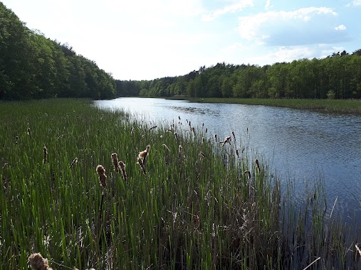
Sławkowy Staw
Sławkowy Staw, 06-114 Dzierżenin, Polska
contacts phone
:
+48
Latitude:
52.575535
, Longitude:
21.0850907
larger map & directions
read more
nearest Natural feature
1.077 km
Jeziorko Żabi Raj
Trzepowo
Natural feature
read more
5.93 km
Góry Pobyłkowskie
Serock
Natural feature
read more
7.38 km
Jezioro Chojno
Polska
Natural feature
read more
7.599 km
Staw Michałówek
Wólka Zaleska
Natural feature
read more
10.658 km
Klub Mila Zegrzynek
Jerzego Szaniawskiego 56, Zegrzynek
Natural feature
read more
10.771 km
Jezioro Zegrzyńskie
Polska
Natural feature
read more
10.894 km
W. Euzebia
Polska
Natural feature
read more
13.627 km
Jez. Parów-Karaski
Polska
Natural feature
read more
14.044 km
Zegrzynskie Jezioro
Polska
Natural feature
read more
14.331 km
Jez. Zegrzyńskie
Polska
Natural feature
read more
15.93 km
Plaża Nieporęt
Zegrzyńska 10H, Nieporęt
Natural feature
read more
16.407 km
Jezioro Kwietniówka
Wieliszew
Natural feature
read more
20.59 km
Parking
Legionowo
Natural feature
read more
21.974 km
Ujęcie wody oligoceńskiej
Legionowo
Natural feature
read more
25.785 km
Trzciany zbiornik
Polen
Natural feature
read more
26.035 km
Osadniki wstępne
Białołęka
Natural feature
read more
26.089 km
Osadniki wtórne
Białołęka
Natural feature
read more
26.162 km
Reaktor biologiczny
Białołęka
Natural feature
read more
27.738 km
Jez. Kiełpińskie
Polska
Natural feature
read more
27.738 km
Jez. Kiełpińskie
Polonia
Natural feature
read more
28.299 km
Jezioro Dziekanowskie
Polonia
Natural feature
read more
28.299 km
Jezioro Dziekanowskie
Poland
Natural feature
read more
28.299 km
Jezioro Dziekanowskie
Polen
Natural feature
read more
28.411 km
Las Dębinka
Nowy Dwór Mazowiecki
Natural feature
read more
32.744 km
Obszar Ochrony Ścisłej Kaliszki
Poland
Natural feature
read more
📑
all categories
Accounting
Administrative area level 1
Administrative area level 2
Airport
Amusement park
Aquarium
Art gallery
Atm
Bakery
Bank
Bar
Beauty salon
Bicycle store
Book store
Bowling alley
Bus station
Cafe
Campground
Car dealer
Car rental
Car repair
Car wash
Casino
Cemetery
Church
City hall
Clothing store
Colloquial area
Convenience store
Courthouse
Dentist
Department store
Doctor
Electrician
Electronics store
Embassy
Finance
Fire station
Florist
Food
Funeral home
Furniture store
Gas station
General contractor
Grocery or supermarket
Gym
Hair care
Hardware store
Health
Hindu Temple
Home goods store
Hospital
Insurance agency
Intersection
Jewelry store
Laundry
Lawyer
Library
Light rail station
Liquor store
Local government office
Locality
Locksmith
Lodging
Meal delivery
Meal takeaway
Mosque
Movie rental
Movie theater
Moving company
Museum
Natural feature
Neighborhood
Night club
Painter
Park
Parking
Pet store
Pharmacy
Physiotherapist
Place of worship
Plumber
Point of interest
Police
Political
Post office
Premise
Real estate agency
Restaurant
Roofing contractor
Route
Rv park, camping
School
Shoe store
Shopping mall
Spa
Stadium
Storage
Store
Subpremise
Subway station
Supermarket
Synagogue
Taxi stand
Train station
Transit station
Travel agency
University
Veterinary care
Zoo
administrative area level 3
sublocality level 1
↑