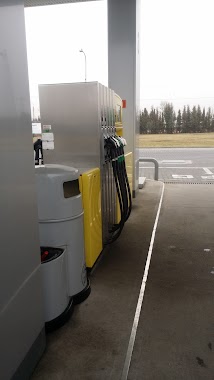
Gas station nearby Stacja Paliw ORLEN
Poland
Gas station nearby Stacja Paliw ORLEN
Stacja Paliw ORLEN
Kampinosa, Kampinos 42, Kampinos Polska
contacts phone
:
+48
Latitude:
52.2668074
, Longitude:
20.4692954
read more
nearest Gas station
6.556 km
MOYA - Granice
Przy drodze nr 92 12a, Granice
Gas station
read more
6.571 km
Stacja Paliw
Granice 12a
Gas station
read more
7.004 km
Parking TIR CPN
Bieniewo-Parcela
Gas station
read more
7.511 km
BP
Łódzka 40, Bramki
Gas station
read more
11.246 km
PEKAES Sp. z o.o.
Modlińska 10, Błonie
Gas station
read more
11.65 km
Lukoil
Sochaczewska 64, Błonie-Wieś
Gas station
read more
12.15 km
Stacja Paliw ORLEN
Sochaczewska, Błonie
Gas station
read more
12.15 km
Orlen
Sochaczewska, Błonie
Gas station
read more
12.867 km
Lotos. Stacja paliw.
Błonie
Gas station
read more
13.056 km
Małpi gaj
3 Maja 14-16, 05-870, Błonie
Gas station
read more
13.145 km
NalPol
Błonie
Gas station
read more
13.448 km
Golden - Stacja Benzynowa
Grodziska 58, Błonie
Gas station
read more
13.453 km
Golden Fuel Station
Grodziska 56, Błonie
Gas station
read more
14.301 km
LPG Butle
Łąkowa 14, Sochaczew
Gas station
read more
14.352 km
Carrefour
Sochaczew
Gas station
read more
14.531 km
BP
Radonice 5D
Gas station
read more
14.561 km
Sakces-Centre Radonice
Radonice 5D
Gas station
read more
15.436 km
Orlen
Warszawska 82, Sochaczew
Gas station
read more
16.03 km
Lukoil
Andrzejów Duranowski 1B, Sochaczew
Gas station
read more
16.114 km
Shell
Żyrardowska 47, Sochaczew
Gas station
read more
16.24 km
Stacja paliw - Jeżówka
Przy drodze nr 50, Jeżówka
Gas station
read more
16.688 km
Stacja Paliw Lotos
Wspólna 3, Cybulice Duże
Gas station
read more
19.31 km
LOTOS. Stacja paliw.
Kotowice 50, Brwinów
Gas station
read more
19.315 km
LOTOS StationMOP A2 Brwinow
Przy A2 (kierunek Warszawa), Brwinów
Gas station
read more
19.343 km
Lotos 815
Kotowice 52
Gas station
read more
📑
all categories
Accounting
Administrative area level 1
Administrative area level 2
Airport
Amusement park
Aquarium
Art gallery
Atm
Bakery
Bank
Bar
Beauty salon
Bicycle store
Book store
Bowling alley
Bus station
Cafe
Campground
Car dealer
Car rental
Car repair
Car wash
Casino
Cemetery
Church
City hall
Clothing store
Colloquial area
Convenience store
Courthouse
Dentist
Department store
Doctor
Electrician
Electronics store
Embassy
Finance
Fire station
Florist
Food
Funeral home
Furniture store
Gas station
General contractor
Grocery or supermarket
Gym
Hair care
Hardware store
Health
Hindu Temple
Home goods store
Hospital
Insurance agency
Intersection
Jewelry store
Laundry
Lawyer
Library
Light rail station
Liquor store
Local government office
Locality
Locksmith
Lodging
Meal delivery
Meal takeaway
Mosque
Movie rental
Movie theater
Moving company
Museum
Natural feature
Neighborhood
Night club
Painter
Park
Parking
Pet store
Pharmacy
Physiotherapist
Place of worship
Plumber
Point of interest
Police
Political
Post office
Premise
Real estate agency
Restaurant
Roofing contractor
Route
Rv park, camping
School
Shoe store
Shopping mall
Spa
Stadium
Storage
Store
Subpremise
Subway station
Supermarket
Synagogue
Taxi stand
Train station
Transit station
Travel agency
University
Veterinary care
Zoo
administrative area level 3
sublocality level 1
↑