Gas station nearby Shell
Poland
Gas station nearby Shell
Shell
Nowolipie 1, Nieporęt Polen
contacts phone
:
+48
Latitude:
52.4322482
, Longitude:
21.0383703
read more
nearest Gas station
29 m
Neste A24 Nieporęt Nowolipie
Wojska Polskiego 3, Nieporęt
Gas station
read more
168 m
Orlen
Wojska Polskiego 3, Nieporęt
Gas station
read more
168 m
Stacja Paliw ORLEN (wodna)
Wojska Polskiego 3, Nieporęt
Gas station
read more
420 m
Shell
Wojska Polskiego 1, Nieporęt
Gas station
read more
433 m
Petrol Station ORLEN
Jana Kazimierza 1, Nieporęt
Gas station
read more
445 m
ORLEN
Wojska Polskiego 1, Nieporęt
Gas station
read more
445 m
Stacja Paliw Orlen
Wojska Polskiego 1, Nieporęt
Gas station
read more
2.924 km
Lotos
Warszawska 44, Zegrze Południowe
Gas station
read more
3.283 km
Rawski. Petrol station
Jana Kazimierza 2, Nieporęt
Gas station
read more
3.283 km
Stacja Benzynowa
Zajazdowa 3, Stanisławów Pierwszy
Gas station
read more
3.283 km
Rawski
Jana Kazimierza 2, Nieporęt
Gas station
read more
4.341 km
Stacja Paliw BLISKA
Modlińska 13, Wieliszew
Gas station
read more
7.835 km
Circle K
Nowodworska 171, Olszewnica Nowa
Gas station
read more
8.443 km
Axana Sp. o.o.
66, Modlińska, Serock
Gas station
read more
8.541 km
Shell
Warszawska 68, Legionowo
Gas station
read more
8.945 km
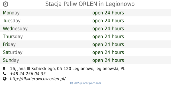
Stacja Paliw ORLEN
Jana III Sobieskiego 16, Legionowo
Gas station
read more
9.589 km
Inne
Nowodworska 5, Skrzeszew
Gas station
read more
10.676 km
LPG - Marki
Cmentarna 2, Marki
Gas station
read more
10.881 km
Petrol Station Artus
Wierzbicka 6, Wierzbica
Gas station
read more
11.803 km
Stacja Paliw ORLEN
Aleja Marszałka Józefa Piłsudskiego 123, Marki
Gas station
read more
14.028 km
Stacja Paliw ORLEN i Sklep
Fabryczna 84, Marki
Gas station
read more
14.347 km
Carrefour
Głębocka 15, Warszawa
Gas station
read more
14.739 km
Stacja Paliw BP
Ulica, Modlińska 29, Warszawa
Gas station
read more
15.675 km
Lotos
Pułkowa 01-971, Warszawa
Gas station
read more
16.483 km
Stacja Paliw ORLEN
Józefa Poniatowskiego 95, Zielonka
Gas station
read more
📑
all categories
Accounting
Administrative area level 1
Administrative area level 2
Airport
Amusement park
Aquarium
Art gallery
Atm
Bakery
Bank
Bar
Beauty salon
Bicycle store
Book store
Bowling alley
Bus station
Cafe
Campground
Car dealer
Car rental
Car repair
Car wash
Casino
Cemetery
Church
City hall
Clothing store
Colloquial area
Convenience store
Courthouse
Dentist
Department store
Doctor
Electrician
Electronics store
Embassy
Finance
Fire station
Florist
Food
Funeral home
Furniture store
Gas station
General contractor
Grocery or supermarket
Gym
Hair care
Hardware store
Health
Hindu Temple
Home goods store
Hospital
Insurance agency
Intersection
Jewelry store
Laundry
Lawyer
Library
Light rail station
Liquor store
Local government office
Locality
Locksmith
Lodging
Meal delivery
Meal takeaway
Mosque
Movie rental
Movie theater
Moving company
Museum
Natural feature
Neighborhood
Night club
Painter
Park
Parking
Pet store
Pharmacy
Physiotherapist
Place of worship
Plumber
Point of interest
Police
Political
Post office
Premise
Real estate agency
Restaurant
Roofing contractor
Route
Rv park, camping
School
Shoe store
Shopping mall
Spa
Stadium
Storage
Store
Subpremise
Subway station
Supermarket
Synagogue
Taxi stand
Train station
Transit station
Travel agency
University
Veterinary care
Zoo
administrative area level 3
sublocality level 1
↑