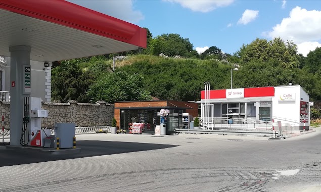
Gas station nearby Circle K
Poland
Gas station nearby Circle K
Circle K
45, Łęczyńska, 20-313, Lublin, Lublin, PL Polonia
contacts phone
:
+48 81 746 53 79
website:
www.circlek.pl
Latitude:
51.241217
, Longitude:
22.588211
larger map & directions
read more
nearest Gas station
Circle K Łęczyńska
ul, Łęczyńska 45, Lublin
Gas station
read more
15 m
Circle K Łęczyńska
Łęczyńska 45, Lublin
Gas station
read more
351 m
Independent Lublin
Hutnicza 1, Lublin
Gas station
read more
388 m
Stacja Paliw Petrodom - Lublin
Hutnicza 1, Lublin
Gas station
read more
454 m
MBX
Hutnicza 3, Lublin
Gas station
read more
527 m
MOYA
Hutnicza 3, Lublin
Gas station
read more
527 m
Petrol Station MOYA
Hutnicza 3, Lublin
Gas station
read more
588 m
eMILA.
Łęczyńska 40, Lublin
Gas station
read more
761 m
Lukoil
Chemiczna 5, Lublin
Gas station
read more
805 m
Carman Lublin
Chemiczna 20, Lublin
Gas station
read more
866 m
Orlen
Droga Męczenników Majdanka 16, Lublin
Gas station
read more
866 m
Stacja Paliw ORLEN
Droga Męczenników Majdanka 16, Lublin
Gas station
read more
870 m
Independent - Lublin
aleja Wincentego Witosa 3, Lublin
Gas station
read more
872 m
Stacja Paliw ORLEN
Aleja Tysiąclecia 31, Lublin
Gas station
read more
872 m
Petrol Station ORLEN
Aleja Tysiąclecia 31, Lublin
Gas station
read more
1000 m
Lukoil
aleja Unii Lubelskiej 10, Lublin
Gas station
read more
1.179 km
Stacja Paliw ORLEN
Mełgiewska 20, Lublin
Gas station
read more
1.179 km
Petrol Station ORLEN
Mełgiewska 20, Lublin
Gas station
read more
1.218 km
TransOil Stacja Benzynowa
Białkowska Góra 20-001, Lublin
Gas station
read more
1.222 km
Stacja paliw Carrefour
aleja Wincentego Witosa 6, Lublin
Gas station
read more
1.222 km
Carrefour petrol station
aleja Wincentego Witosa 6, Lublin
Gas station
read more
1.942 km
LPG Krochmalna
Krochmalna 20, Lublin
Gas station
read more
2.03 km
Prywatna
Młyńska 20, Lublin
Gas station
read more
2.26 km
Shell
Aleja Solidarności, Bolesława Prusa 8, Lublin
Gas station
read more
2.269 km
Auchan
Witosa 32a, Lublin
Gas station
read more
📑
all categories
Accounting
Administrative area level 1
Administrative area level 2
Airport
Amusement park
Aquarium
Art gallery
Atm
Bakery
Bank
Bar
Beauty salon
Bicycle store
Book store
Bowling alley
Bus station
Cafe
Campground
Car dealer
Car rental
Car repair
Car wash
Casino
Cemetery
Church
City hall
Clothing store
Colloquial area
Convenience store
Courthouse
Dentist
Department store
Doctor
Electrician
Electronics store
Embassy
Finance
Fire station
Florist
Food
Funeral home
Furniture store
Gas station
General contractor
Grocery or supermarket
Gym
Hair care
Hardware store
Health
Hindu Temple
Home goods store
Hospital
Insurance agency
Intersection
Jewelry store
Laundry
Lawyer
Library
Light rail station
Liquor store
Local government office
Locality
Locksmith
Lodging
Meal delivery
Meal takeaway
Mosque
Movie rental
Movie theater
Moving company
Museum
Natural feature
Neighborhood
Night club
Painter
Park
Parking
Pet store
Pharmacy
Physiotherapist
Place of worship
Plumber
Point of interest
Police
Political
Post office
Premise
Real estate agency
Restaurant
Roofing contractor
Route
Rv park, camping
School
Shoe store
Shopping mall
Spa
Stadium
Storage
Store
Subpremise
Subway station
Supermarket
Synagogue
Taxi stand
Train station
Transit station
Travel agency
University
Veterinary care
Zoo
administrative area level 3
sublocality level 1
↑