Gas station nearby BP
Poland
Gas station nearby BP
BP
Stare Babice, Warszawska Polska
contacts phone
:
+48
Latitude:
52.2474317
, Longitude:
20.8455094
read more
nearest Gas station
7 m
BP Petrol Station
Warszawska 191, Stare Babice
Gas station
read more
7 m
Stacja Paliw BP
Warszawska 191, Stare Babice
Gas station
read more
10 m
BP
Stare Babice
Gas station
read more
220 m
Stacja LPG
Ogrodnicza 2, Stare Babice
Gas station
read more
2.851 km
Nova Oil Sp. z o.o.
Antoniego Kocjana 3, Warszawa
Gas station
read more
3.192 km
M.J.Oil Sp. z o.o. Stacja patronacka Lotos
Świerkowa 4, Bronisze
Gas station
read more
3.274 km
Paw-Lik
Warszawska 2, Blizne Łaszczyńskiego
Gas station
read more
3.577 km
LOTOS. Stacja paliw.
Poznańska 42, Jawczyce
Gas station
read more
3.577 km
Lotos
Poznańska 42, Jawczyce
Gas station
read more
3.655 km
Petrol Station ORLEN
Lazurowa 40, Warszawa
Gas station
read more
3.689 km
Lotos Sp075 Klaudyn
Estrady 5, Warszawa
Gas station
read more
3.69 km
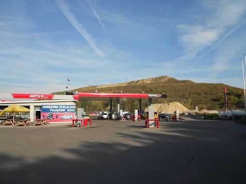
Artus
Estrady 4, Klaudyn
Gas station
read more
3.814 km
Printmax sp.j. Kunysz D., Szor A.
Sochaczewska 37, Warszawa
Gas station
read more
4.138 km
Tesco Petrol Station
Górczewska 218, Warszawa
Gas station
read more
4.299 km
PKN Orlen S.A. Baza magazynowa nr 101
Estrady 8, Mościska
Gas station
read more
4.521 km
Circle K Warszawa
Secemińska 15A, Warszawa
Gas station
read more
4.672 km
Bhp Service
Bolkowska 8, Warszawa
Gas station
read more
4.925 km
Stacja Paliw Lukoil
Połczyńska 84, Warszawa
Gas station
read more
4.967 km
Petrol Station ORLEN
Estrady 13, Mościska
Gas station
read more
5.63 km
Stacja Paliw Circle K
ul, Połczyńska 30, Warszawa
Gas station
read more
5.698 km
BP
Połczyńska 33A, Warszawa
Gas station
read more
5.891 km
LOTOS. Stacja paliw.
Arkuszowa 22, Warszawa
Gas station
read more
6.193 km
Stacja paliw Petrodom - Ożarów Mazowiecki
Poznańska 360, Ożarów Mazowiecki
Gas station
read more
6.193 km
Petrodom
Poznańska 360, Ożarów Mazowiecki
Gas station
read more
6.219 km
LPG - Warszawa
Wólczyńska 133, Warszawa
Gas station
read more
📑
all categories
Accounting
Administrative area level 1
Administrative area level 2
Airport
Amusement park
Aquarium
Art gallery
Atm
Bakery
Bank
Bar
Beauty salon
Bicycle store
Book store
Bowling alley
Bus station
Cafe
Campground
Car dealer
Car rental
Car repair
Car wash
Casino
Cemetery
Church
City hall
Clothing store
Colloquial area
Convenience store
Courthouse
Dentist
Department store
Doctor
Electrician
Electronics store
Embassy
Finance
Fire station
Florist
Food
Funeral home
Furniture store
Gas station
General contractor
Grocery or supermarket
Gym
Hair care
Hardware store
Health
Hindu Temple
Home goods store
Hospital
Insurance agency
Intersection
Jewelry store
Laundry
Lawyer
Library
Light rail station
Liquor store
Local government office
Locality
Locksmith
Lodging
Meal delivery
Meal takeaway
Mosque
Movie rental
Movie theater
Moving company
Museum
Natural feature
Neighborhood
Night club
Painter
Park
Parking
Pet store
Pharmacy
Physiotherapist
Place of worship
Plumber
Point of interest
Police
Political
Post office
Premise
Real estate agency
Restaurant
Roofing contractor
Route
Rv park, camping
School
Shoe store
Shopping mall
Spa
Stadium
Storage
Store
Subpremise
Subway station
Supermarket
Synagogue
Taxi stand
Train station
Transit station
Travel agency
University
Veterinary care
Zoo
administrative area level 3
sublocality level 1
↑