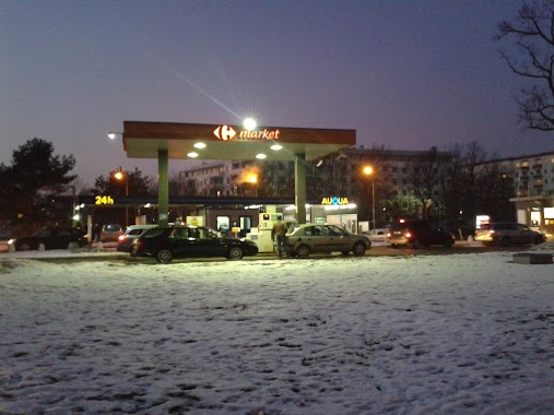
Gas station nearby Auto-Gaz Marymoncka
Poland
Gas station nearby Auto-Gaz Marymoncka
Auto-Gaz Marymoncka
Marymoncka 1, Warszawa Polonia
contacts phone
:
+48
Latitude:
52.299112
, Longitude:
20.942366
read more
nearest Gas station
952 m
Petrol Station ORLEN
Heroldów 1, Warszawa
Gas station
read more
952 m
Stacja Paliw ORLEN
Heroldów 1, Warszawa
Gas station
read more
1.014 km
Stacja Paliw ORLEN
Marymoncka 127, Warszawa
Gas station
read more
1.014 km
Petrol Station ORLEN
Marymoncka 127, Warszawa
Gas station
read more
1.277 km
Lotos
Pułkowa 01-971, Warszawa
Gas station
read more
1.277 km
Stacja Paliw Lotos
Pułkowa 01-971, Warszawa
Gas station
read more
1.337 km
Lukoil
Kasprowicza 115, Warszawa
Gas station
read more
1.851 km
Bliska Warszawa Reymonta
Reymonta 40, Warszawa
Gas station
read more
1.855 km
Stacja Paliw ORLEN
Reymonta 40, Warszawa
Gas station
read more
1.872 km
Stacja ręcznego prania tapicerki
Wawrzyszew, 00-001
Gas station
read more
1.882 km
Shell
Sokratesa 11, Warszawa
Gas station
read more
2.094 km
Lotos
Pułkowa, Warszawa
Gas station
read more
2.094 km
LOTOS Optima. Stacja paliw.
Pułkowa, Warszawa
Gas station
read more
2.206 km
Wasbruk LPG 24H
Myśliborska 53, Warszawa
Gas station
read more
2.424 km
Circle K
Conrada 29B, Warszawa
Gas station
read more
2.433 km
Myjnia Circle K
Conrada 29, Warszawa
Gas station
read more
2.536 km
LPG - Warszawa
Wólczyńska 133, Warszawa
Gas station
read more
2.674 km
Stacja paliw Carrefour
Światowida 18, Warszawa
Gas station
read more
2.871 km
LOTOS. Stacja paliw.
Arkuszowa 22, Warszawa
Gas station
read more
2.871 km
Lotos
Arkuszowa 22, Warszawa
Gas station
read more
2.874 km
Wasbruk Stacja LPG
Modlińska 65, Warszawa
Gas station
read more
2.947 km
Circle K
ul, Modlińska 144, Warszawa
Gas station
read more
3.051 km
BP
Modlińska 195, Warszawa
Gas station
read more
3.082 km
Wasbruk Modlińska
Modlińska 0, Warszawa
Gas station
read more
3.209 km
Shell
aleja Armii Krajowej 10, Warszawa
Gas station
read more
📑
all categories
Accounting
Administrative area level 1
Administrative area level 2
Airport
Amusement park
Aquarium
Art gallery
Atm
Bakery
Bank
Bar
Beauty salon
Bicycle store
Book store
Bowling alley
Bus station
Cafe
Campground
Car dealer
Car rental
Car repair
Car wash
Casino
Cemetery
Church
City hall
Clothing store
Colloquial area
Convenience store
Courthouse
Dentist
Department store
Doctor
Electrician
Electronics store
Embassy
Finance
Fire station
Florist
Food
Funeral home
Furniture store
Gas station
General contractor
Grocery or supermarket
Gym
Hair care
Hardware store
Health
Hindu Temple
Home goods store
Hospital
Insurance agency
Intersection
Jewelry store
Laundry
Lawyer
Library
Light rail station
Liquor store
Local government office
Locality
Locksmith
Lodging
Meal delivery
Meal takeaway
Mosque
Movie rental
Movie theater
Moving company
Museum
Natural feature
Neighborhood
Night club
Painter
Park
Parking
Pet store
Pharmacy
Physiotherapist
Place of worship
Plumber
Point of interest
Police
Political
Post office
Premise
Real estate agency
Restaurant
Roofing contractor
Route
Rv park, camping
School
Shoe store
Shopping mall
Spa
Stadium
Storage
Store
Subpremise
Subway station
Supermarket
Synagogue
Taxi stand
Train station
Transit station
Travel agency
University
Veterinary care
Zoo
administrative area level 3
sublocality level 1
↑