Bar nearby Tlenownia
Poland
Bar nearby Tlenownia
Tlenownia
Leszczyńska 4, Bielsko-Biała Poland
contacts phone
:
+48
Latitude:
49.8091418
, Longitude:
19.0465918
read more
nearest Bar
708 m
Pizzeria & Klub Miasto
plac Adama Mickiewicza 2, Bielsko-Biała
Bar
read more
1.168 km
Oscar Wilde Pub. Klub studencki
Sikorskiego 4, Bielsko-Biała
Bar
read more
1.18 km
Stolarnia. Pub
Władysława Broniewskiego 19, Bielsko-Biała
Bar
read more
1.332 km
Środek
1 Maja 1, Bielsko-Biała
Bar
read more
1.333 km
Dog's Bollocks Pub
Rynek 28, Bielsko-Biała
Bar
read more
1.345 km
Rewers Cocktail & Coffee
Rynek 2, Bielsko-Biała
Bar
read more
1.358 km
Opium - Klub Muzyczny
300, Rynek 4, Bielsko-Biała
Bar
read more
1.376 km
Chillout Pub
Rynek 6, Bielsko-Biała
Bar
read more
1.389 km
Celna 10
Celna 10, Bielsko-Biała
Bar
read more
1.391 km
Craftbar
Rynek 10, Bielsko-Biała
Bar
read more
1.414 km
Chmielowe podcienia
Podcienie 3, Bielsko-Biała
Bar
read more
1.428 km
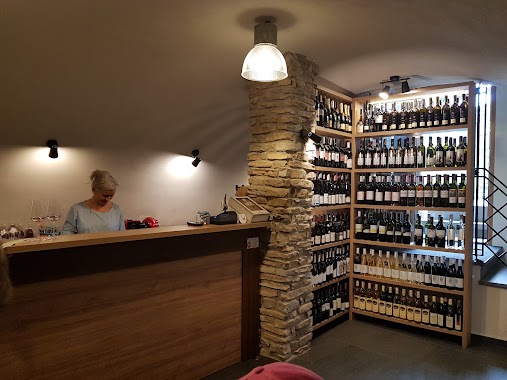
Malokarpatská vinotéka
Podcienie 13A, Bielsko-Biała
Bar
read more
1.436 km
Piwnica Zamkowa
16, Wzgórze, Bielsko-Biała
Bar
read more
1.449 km
Bistro
Bielsko-Biala
Bar
read more
1.473 km
Farma Cafe
plac, plac Franciszka Smolki 7, Bielsko-Biała
Bar
read more
1.483 km
Pigal Cafe
Wzgórze 19, Bielsko-Biała
Bar
read more
1.547 km
Pub Rudy
Mickiewicza 8, Bielsko-Biała
Bar
read more
1.547 km
Pod Rudym Kotem
Mickiewicza 8, Bielsko-Biała
Bar
read more
1.638 km
Piwiarnia WARKA
Cechowa 18, Bielsko-Biała
Bar
read more
1.649 km
Rock Cafe
Norberta Barlickiego 10, Bielsko-Biała
Bar
read more
1.743 km
Rock Galeria
Stanisława Staszica 7, Bielsko-Biała
Bar
read more
1.753 km
All Star's Pub
Cyniarska 28, Bielsko-Biała
Bar
read more
1.778 km
Sephia
3 Maja 13, Bielsko-Biała
Bar
read more
2.155 km
Bar "Miś"
Wita Stwosza 12, Bielsko-Biała
Bar
read more
2.199 km
Magnum Pub
Emilii Plater 21, Bielsko-Biała
Bar
read more
📑
all categories
Accounting
Administrative area level 1
Administrative area level 2
Airport
Amusement park
Aquarium
Art gallery
Atm
Bakery
Bank
Bar
Beauty salon
Bicycle store
Book store
Bowling alley
Bus station
Cafe
Campground
Car dealer
Car rental
Car repair
Car wash
Casino
Cemetery
Church
City hall
Clothing store
Colloquial area
Convenience store
Courthouse
Dentist
Department store
Doctor
Electrician
Electronics store
Embassy
Finance
Fire station
Florist
Food
Funeral home
Furniture store
Gas station
General contractor
Grocery or supermarket
Gym
Hair care
Hardware store
Health
Hindu Temple
Home goods store
Hospital
Insurance agency
Intersection
Jewelry store
Laundry
Lawyer
Library
Light rail station
Liquor store
Local government office
Locality
Locksmith
Lodging
Meal delivery
Meal takeaway
Mosque
Movie rental
Movie theater
Moving company
Museum
Natural feature
Neighborhood
Night club
Painter
Park
Parking
Pet store
Pharmacy
Physiotherapist
Place of worship
Plumber
Point of interest
Police
Political
Post office
Premise
Real estate agency
Restaurant
Roofing contractor
Route
Rv park, camping
School
Shoe store
Shopping mall
Spa
Stadium
Storage
Store
Subpremise
Subway station
Supermarket
Synagogue
Taxi stand
Train station
Transit station
Travel agency
University
Veterinary care
Zoo
administrative area level 3
sublocality level 1
↑