Bar nearby PUB Agawa
Poland
Bar nearby PUB Agawa
PUB Agawa
49, Jana Pawła II, 41-940, Piekary Śląskie, Piekary Śląskie, PL Poland
contacts phone
:
+48
Latitude:
50.3905965
, Longitude:
18.9519672
larger map & directions
read more
nearest Bar
684 m
Pub OdNowa
4, Diamentowa, Piekary Śląskie
Bar
read more
1.332 km
Bifyj Pub
ul, Bytomska 121, Piekary Śląskie
Bar
read more
3.251 km
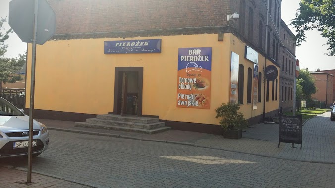
Bar Pierożek
940, Oświęcimska 72, Piekary Śląskie
Bar
read more
3.315 km
Piri Kebab
Oświęcimska 88, Piekary Śląskie
Bar
read more
3.321 km
Mała Bawaria
Oświęcimska 88, Piekary Śląskie
Bar
read more
3.393 km
Bar U Andrzeja
Oświęcimska 98, Piekary Śląskie
Bar
read more
3.567 km
Sissel. Bar
świętego Wojciecha 17, Radzionków
Bar
read more
3.649 km
Reduta
Bezpieczna 1A, Radzionków
Bar
read more
3.698 km
Wędzarnia
Zofii Nałkowskiej 5, Radzionków
Bar
read more
3.915 km
Bar Danusia
Biskupa Nankera 184, Piekary Śląskie
Bar
read more
4.002 km
ABC
41-949, Marii Curie-Skłodowskiej, Piekary Śląskie
Bar
read more
4.487 km
Swojskie burgery
96 (przy drugim, wejściu, Strzelców Bytomskich, Bytom
Bar
read more
5.062 km
Bistro Koperek
Marszałka Józefa Piłsudskiego 54, Bytom
Bar
read more
5.105 km
zelter
Strażacka 3A, Bytom
Bar
read more
5.157 km
Pub Gotyk
902, Kościelna 2, Bytom
Bar
read more
5.184 km
FAJRANT
Stanisława Webera 2, Bytom
Bar
read more
5.191 km
bajzel
Rycerska 17, Bytom
Bar
read more
5.192 km
Piątek Jerzy. Pub
Rycerska 7, Bytom
Bar
read more
5.2 km
Minibrowar Piwnica Gawronòw
Rynek 12, Bytom
Bar
read more
5.242 km
Pub 14
Rynek, Bytom
Bar
read more
5.282 km
Fuchs
Krakowska 2, Bytom
Bar
read more
5.302 km
Pin-Up! Music&Bowling
Centrum Handlowe Agora, plac Kościuszki 1, Bytom
Bar
read more
5.344 km
Uniwersalny. Bar. Sulima A.
księdza Biskupa Herberta Bednorza 8, Piekary Śląskie
Bar
read more
5.535 km
Bar Leśna Przystań
42-624 Ossy; Wyzwolenia 23
Bar
read more
5.826 km
Mirage, Franas R.
Stanisława Wyspiańskiego 1, Bytom
Bar
read more
📑
all categories
Accounting
Administrative area level 1
Administrative area level 2
Airport
Amusement park
Aquarium
Art gallery
Atm
Bakery
Bank
Bar
Beauty salon
Bicycle store
Book store
Bowling alley
Bus station
Cafe
Campground
Car dealer
Car rental
Car repair
Car wash
Casino
Cemetery
Church
City hall
Clothing store
Colloquial area
Convenience store
Courthouse
Dentist
Department store
Doctor
Electrician
Electronics store
Embassy
Finance
Fire station
Florist
Food
Funeral home
Furniture store
Gas station
General contractor
Grocery or supermarket
Gym
Hair care
Hardware store
Health
Hindu Temple
Home goods store
Hospital
Insurance agency
Intersection
Jewelry store
Laundry
Lawyer
Library
Light rail station
Liquor store
Local government office
Locality
Locksmith
Lodging
Meal delivery
Meal takeaway
Mosque
Movie rental
Movie theater
Moving company
Museum
Natural feature
Neighborhood
Night club
Painter
Park
Parking
Pet store
Pharmacy
Physiotherapist
Place of worship
Plumber
Point of interest
Police
Political
Post office
Premise
Real estate agency
Restaurant
Roofing contractor
Route
Rv park, camping
School
Shoe store
Shopping mall
Spa
Stadium
Storage
Store
Subpremise
Subway station
Supermarket
Synagogue
Taxi stand
Train station
Transit station
Travel agency
University
Veterinary care
Zoo
administrative area level 3
sublocality level 1
↑