Bar nearby Pod Magnolią. Pub
Poland
Bar nearby Pod Magnolią. Pub
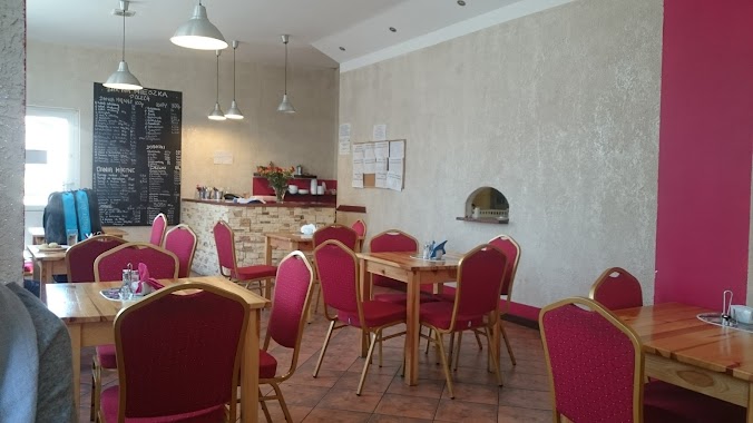
Pod Magnolią. Pub
2, Stefana Batorego, 76-200, Słupsk, Słupsk, PL Polen
contacts phone
:
+48 696 029 106
Latitude:
54.4746147
, Longitude:
17.0094219
larger map & directions
read more
nearest Bar
116 m
KEBSIK
aleja 3 Maja 80A, Słupsk
Bar
read more
199 m
Maja. Bar. Kierul E.
Stanisława Leszczyńskiego 2, Słupsk
Bar
read more
315 m
Gaweł. Bar. Drążkowscy S.M.
Aleja 3-go Maja 77, Słupsk
Bar
read more
539 m
SportPub
Aleja 3-go Maja 43, Słupsk
Bar
read more
963 m
Kurczak Bar
Słupsk
Bar
read more
1.347 km
Bar Maja
Mikołaja Kopernika 37-38, Słupsk
Bar
read more
1.434 km
Zapiekanka Krakowska
Stefana Starzyńskiego 6-7, Słupsk
Bar
read more
1.476 km
Bar "Hai-Yen"
Jedności Narodowej 2, Słupsk
Bar
read more
1.508 km
Buddhas
Grodzka 11, Słupsk
Bar
read more
1.51 km
B4
Murarska, Słupsk
Bar
read more
1.541 km
Piwiarnia Warka
Anny Łajming 3, Słupsk
Bar
read more
1.545 km
Motor Rock
Anny Łajming 3, Słupsk
Bar
read more
1.545 km
Motor Rock. Pub
Anny Łajming 3, Słupsk
Bar
read more
1.545 km
Pizzeria "Pod Łabędziem"
Traugutta 17, Słupsk
Bar
read more
1.568 km
The William Wallace
ul. -10, Generała Józefa Bema 9, Słupsk
Bar
read more
2.126 km
Pub Koral
Generała Władysława Andersa 10, Słupsk
Bar
read more
2.145 km
Bar Rabarbar
Profesora Eugeniusza Romera 2C, Słupsk
Bar
read more
2.385 km
Bar Mieszko
Mieszka I 9, Słupsk
Bar
read more
2.442 km
BAR SADEŁKO menu
Romana Dmowskiego 10, Słupsk
Bar
read more
2.442 km
BAR SADEŁKO menu
Romana Dmowskiego 10,Słupsk, Słupsk
Bar
read more
2.442 km
BAR SADEŁKO
Romana Dmowskiego 10, Słupsk
Bar
read more
2.489 km
BAR Maja
Wiejska 29, Słupsk
Bar
read more
3.48 km
Royal Bar
Gdyńska 36, Słupsk
Bar
read more
7.051 km
Bar Przygoda przy Parku Wodnym
Redzikowo 16b
Bar
read more
📑
all categories
Accounting
Administrative area level 1
Administrative area level 2
Airport
Amusement park
Aquarium
Art gallery
Atm
Bakery
Bank
Bar
Beauty salon
Bicycle store
Book store
Bowling alley
Bus station
Cafe
Campground
Car dealer
Car rental
Car repair
Car wash
Casino
Cemetery
Church
City hall
Clothing store
Colloquial area
Convenience store
Courthouse
Dentist
Department store
Doctor
Electrician
Electronics store
Embassy
Finance
Fire station
Florist
Food
Funeral home
Furniture store
Gas station
General contractor
Grocery or supermarket
Gym
Hair care
Hardware store
Health
Hindu Temple
Home goods store
Hospital
Insurance agency
Intersection
Jewelry store
Laundry
Lawyer
Library
Light rail station
Liquor store
Local government office
Locality
Locksmith
Lodging
Meal delivery
Meal takeaway
Mosque
Movie rental
Movie theater
Moving company
Museum
Natural feature
Neighborhood
Night club
Painter
Park
Parking
Pet store
Pharmacy
Physiotherapist
Place of worship
Plumber
Point of interest
Police
Political
Post office
Premise
Real estate agency
Restaurant
Roofing contractor
Route
Rv park, camping
School
Shoe store
Shopping mall
Spa
Stadium
Storage
Store
Subpremise
Subway station
Supermarket
Synagogue
Taxi stand
Train station
Transit station
Travel agency
University
Veterinary care
Zoo
administrative area level 3
sublocality level 1
↑