Bar nearby Kebab Bar pod M1
Poland
Bar nearby Kebab Bar pod M1
Kebab Bar pod M1
Unnamed Road, Łódź Polska
contacts phone
:
+48
Latitude:
51.7936034
, Longitude:
19.5106644
read more
nearest Bar
504 m
Obiady Domowe U' Notariusza
Brzezińska 20, Łódź
Bar
read more
744 m
Brzezińska cars and blues
3, Brzezińska 1/7, Łódź
Bar
read more
1.882 km
Victory. Bar. Szymczak M.
Styrska 20/24, Łódź
Bar
read more
2.016 km
Saxofon
Patrice Lumumby 1/3, Łódź
Bar
read more
2.044 km
Hell's Kitchen Lumumby 10
Patrice Lumumby, Łódź
Bar
read more
2.066 km
Kogel Mogel u Janka
Pomorska 185, Łódź
Bar
read more
2.235 km
Ganek
Pomorska 311, Łódź
Bar
read more
2.33 km
Janowska Urszula. Bar obiadowy
aleja Grzegorza Palki 5, Łódź
Bar
read more
2.482 km
Góralska Chata
92-703, Brzezińska 124, Łódź
Bar
read more
2.885 km
Musztarda Po Obiedzie
Pomorska 86, Łódź
Bar
read more
2.973 km
RUGBUŚ OBIADY DOMOWE
Górnicza 5, Łódź
Bar
read more
2.973 km
Noclegi/bar
Górnicza 5, Łódź
Bar
read more
2.974 km
Grill Bar Agat
Strykowska 92, Łódź
Bar
read more
3.236 km
Naleśnikarnia & Pierogarnia
Rewolucji 1905 r 76, Łódź
Bar
read more
3.314 km
Sznycelek
Narutowicza 75A, Łódź
Bar
read more
3.416 km
WłóKafe & Arepas
Narutowicza 69, Łódź
Bar
read more
3.821 km
Obiady U'Notariusza
Narutowicza 41, Łódź
Bar
read more
4.031 km
BAR CEGIELNIA
Tokarska 2, Łódź
Bar
read more
4.033 km
Pub Victoria
Jana Kilińskiego 46, Łódź
Bar
read more
4.053 km
Bistro KATARZYNKA
Piłsudskiego 71, Łódź
Bar
read more
4.085 km
Pub Stary Rynek
Stary Rynek 1, Łódź
Bar
read more
4.32 km
Pop'n'Art
plac Wolności 6, Łódź
Bar
read more
4.62 km
Arena Laser Games
Drewnowska 58, Łódź
Bar
read more
4.915 km
M3 PUB
Andrzeja Struga 4, Łódź
Bar
read more
5.307 km
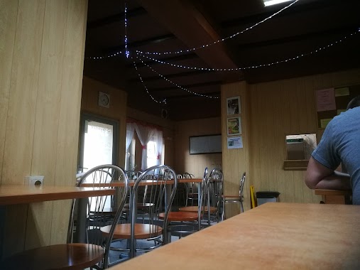
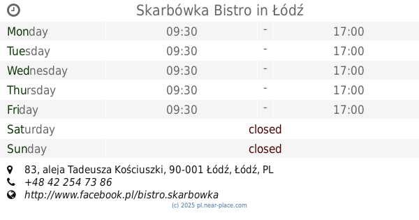
Skarbówka Bistro
aleja Tadeusza Kościuszki 83, Łódź
Bar
read more
📑
all categories
Accounting
Administrative area level 1
Administrative area level 2
Airport
Amusement park
Aquarium
Art gallery
Atm
Bakery
Bank
Bar
Beauty salon
Bicycle store
Book store
Bowling alley
Bus station
Cafe
Campground
Car dealer
Car rental
Car repair
Car wash
Casino
Cemetery
Church
City hall
Clothing store
Colloquial area
Convenience store
Courthouse
Dentist
Department store
Doctor
Electrician
Electronics store
Embassy
Finance
Fire station
Florist
Food
Funeral home
Furniture store
Gas station
General contractor
Grocery or supermarket
Gym
Hair care
Hardware store
Health
Hindu Temple
Home goods store
Hospital
Insurance agency
Intersection
Jewelry store
Laundry
Lawyer
Library
Light rail station
Liquor store
Local government office
Locality
Locksmith
Lodging
Meal delivery
Meal takeaway
Mosque
Movie rental
Movie theater
Moving company
Museum
Natural feature
Neighborhood
Night club
Painter
Park
Parking
Pet store
Pharmacy
Physiotherapist
Place of worship
Plumber
Point of interest
Police
Political
Post office
Premise
Real estate agency
Restaurant
Roofing contractor
Route
Rv park, camping
School
Shoe store
Shopping mall
Spa
Stadium
Storage
Store
Subpremise
Subway station
Supermarket
Synagogue
Taxi stand
Train station
Transit station
Travel agency
University
Veterinary care
Zoo
administrative area level 3
sublocality level 1
↑