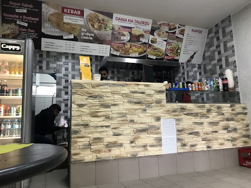
Bar nearby Jama
Poland
Bar nearby Jama
Jama
64/68, aleja Niepodległości, 02-626, Warszawa, Warszawa, PL Polonia
contacts phone
:
+48
Latitude:
52.1938516
, Longitude:
21.0153245
larger map & directions
read more
nearest Bar
118 m
Pizzeria Pizzaiolo Cesare
Antoniego Malczewskiego 42b, Warszawa
Bar
read more
165 m
Bar Jedzonko
Antoniego Malczewskiego 46, Warszawa
Bar
read more
327 m
Fiesta i Siesta
Mahatmy Gandhiego 7, Warszawa
Bar
read more
499 m
Delhi kebab
Jana Bytnara „Rudego” 62, Warszawa
Bar
read more
645 m
Cafe Racławicka
Racławicka 17, Warszawa
Bar
read more
715 m
Kantyna Wojskowe Smaki
aleja Niepodległości 121/123, Warszawa
Bar
read more
801 m
Music Bar
Olkuska 1, Warszawa
Bar
read more
820 m
Burger Bar
Puławska 74/80, Warszawa
Bar
read more
824 m
vege małpa
Racławicka 7, Warszawa
Bar
read more
837 m
Sao Do Son Son Bar Orientalny
74/80, Puławska, Warszawa
Bar
read more
837 m
Sao Do Son Son Bar Orientalny
Puławska 74/80, Warszawa
Bar
read more
856 m
Bar Azjatycki Wołoska/Racławicka
Racławicka 46, Warszawa
Bar
read more
867 m
Jelonsio
Wojciecha Żywnego 21A, Warszawa
Bar
read more
887 m
Bar MiLi
Warszawa
Bar
read more
887 m
Bar MiLi
Warsaw
Bar
read more
891 m
Pierogarnia, Pawilon 22
Wołoska 56, Warszawa
Bar
read more
914 m
Bar Tuluc
Wołoska 70, Warszawa
Bar
read more
941 m
Winiarnia Żużu
02-572 wejscie naprzeciwko ul rozanej 43, Kazimierzowska 43, Warszawa
Bar
read more
1.023 km
Admiral Casino Drink Bar Salon gier
Puławska 73/75, Warszawa
Bar
read more
1.047 km
Mokomoko
Garażowa 4, Warszawa
Bar
read more
1.068 km
Fort Szeląg
Miączyńska 5, Warszawa
Bar
read more
1.11 km
Koktajl Mokotowa
Puławska 67, Warszawa
Bar
read more
1.714 km
Wagon Pub
Sobieskiego 100A, Warszawa
Bar
read more
1.83 km
Klubokawiarnia "Daleko jeszcze?"
Woronicza Street 33b, Warszawa
Bar
read more
2.029 km
Stegny Bistro
Unnamed Road
Bar
read more
📑
all categories
Accounting
Administrative area level 1
Administrative area level 2
Airport
Amusement park
Aquarium
Art gallery
Atm
Bakery
Bank
Bar
Beauty salon
Bicycle store
Book store
Bowling alley
Bus station
Cafe
Campground
Car dealer
Car rental
Car repair
Car wash
Casino
Cemetery
Church
City hall
Clothing store
Colloquial area
Convenience store
Courthouse
Dentist
Department store
Doctor
Electrician
Electronics store
Embassy
Finance
Fire station
Florist
Food
Funeral home
Furniture store
Gas station
General contractor
Grocery or supermarket
Gym
Hair care
Hardware store
Health
Hindu Temple
Home goods store
Hospital
Insurance agency
Intersection
Jewelry store
Laundry
Lawyer
Library
Light rail station
Liquor store
Local government office
Locality
Locksmith
Lodging
Meal delivery
Meal takeaway
Mosque
Movie rental
Movie theater
Moving company
Museum
Natural feature
Neighborhood
Night club
Painter
Park
Parking
Pet store
Pharmacy
Physiotherapist
Place of worship
Plumber
Point of interest
Police
Political
Post office
Premise
Real estate agency
Restaurant
Roofing contractor
Route
Rv park, camping
School
Shoe store
Shopping mall
Spa
Stadium
Storage
Store
Subpremise
Subway station
Supermarket
Synagogue
Taxi stand
Train station
Transit station
Travel agency
University
Veterinary care
Zoo
administrative area level 3
sublocality level 1
↑