Subway station nearby Imielin metro station
Coronavirus disease (COVID-19) Situation
confirmed cases
6661991
deaths
120598
Poland
Subway station nearby Imielin metro station
Imielin metro station
00-001 Varsovia, Polonia
contacts phone
:
+48
Latitude:
52.150124
, Longitude:
21.0454595
larger map & directions
read more
nearest Subway station
1.367 km
Natolin
Belgradzka, Warszawa
Subway station
read more
1.795 km
Ursynów
Poland
Subway station
read more
2.479 km
Kabaty
Komisji Edukacji Narodowej, Warszawa
Subway station
read more
2.904 km
Służew
Poland
Subway station
read more
3.829 km
Wilanowska
Poland
Subway station
read more
4.874 km
Wierzbno
Poland
Subway station
read more
5.904 km
Racławicka
Poland
Subway station
read more
7.023 km
Pole Mokotowskie
Poland
Subway station
read more
7.792 km
Politechnika Metro Station
Poland
Subway station
read more
9.239 km
Centrum
Poland
Subway station
read more
9.768 km
Rondo ONZ
Rondo ONZ, Warszawa
Subway station
read more
9.793 km
Świętokrzyska
Marszałkowska 0, Warszawa
Subway station
read more
9.828 km
Nowy Świat-Uniwersytet
Nowy Świat 0, Warszawa
Subway station
read more
9.852 km
Rondo Daszyńskiego
Rondo Daszyńskiego, Warszawa
Subway station
read more
10 km
Centrum Nauki Kopernik
Wybrzeże Kościuszkowskie, Warszawa
Subway station
read more
10.678 km
Stadion Narodowy
Sokola, Warszawa
Subway station
read more
10.957 km
Ratusz Arsenał
Poland
Subway station
read more
11.592 km
Dworzec Wileński
aleja "Solidarności" 3, Warszawa
Subway station
read more
12.485 km
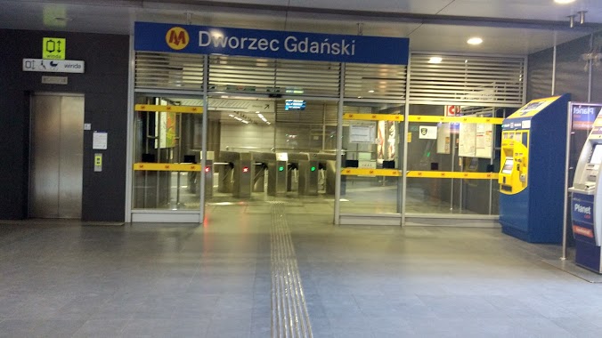
Dworzec Gdański
Poland
Subway station
read more
13.83 km
Plac Wilsona
00-001, Warszawa
Subway station
read more
14.435 km
Marymont
Słowackiego, Warszawa
Subway station
read more
15.254 km
Słodowiec
Poland
Subway station
read more
15.975 km
Stare Bielany
Poland
Subway station
read more
16.82 km
Wawrzyszew
Poland
Subway station
read more
17.445 km
Młociny
Nocznickiego, Warszawa
Subway station
read more
📑
all categories
Accounting
Administrative area level 1
Administrative area level 2
Airport
Amusement park
Aquarium
Art gallery
Atm
Bakery
Bank
Bar
Beauty salon
Bicycle store
Book store
Bowling alley
Bus station
Cafe
Campground
Car dealer
Car rental
Car repair
Car wash
Casino
Cemetery
Church
City hall
Clothing store
Colloquial area
Convenience store
Courthouse
Dentist
Department store
Doctor
Electrician
Electronics store
Embassy
Finance
Fire station
Florist
Food
Funeral home
Furniture store
Gas station
General contractor
Grocery or supermarket
Gym
Hair care
Hardware store
Health
Hindu Temple
Home goods store
Hospital
Insurance agency
Intersection
Jewelry store
Laundry
Lawyer
Library
Light rail station
Liquor store
Local government office
Locality
Locksmith
Lodging
Meal delivery
Meal takeaway
Mosque
Movie rental
Movie theater
Moving company
Museum
Natural feature
Neighborhood
Night club
Painter
Park
Parking
Pet store
Pharmacy
Physiotherapist
Place of worship
Plumber
Point of interest
Police
Political
Post office
Premise
Real estate agency
Restaurant
Roofing contractor
Route
Rv park, camping
School
Shoe store
Shopping mall
Spa
Stadium
Storage
Store
Subpremise
Subway station
Supermarket
Synagogue
Taxi stand
Train station
Transit station
Travel agency
University
Veterinary care
Zoo
administrative area level 3
sublocality level 1
↑