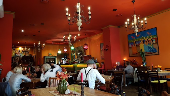
Restaurant nearby TanioAleDobrze
Coronavirus disease (COVID-19) Situation
confirmed cases
6661991
deaths
120598
Poland
Restaurant nearby TanioAleDobrze
TanioAleDobrze
Władysława Truchana 28, Chorzów Polska
contacts phone
:
+48
Latitude:
50.2959591
, Longitude:
18.9462876
read more
nearest Restaurant
118 m
Pizzeria La Tirasia
Bolesława Chrobrego 2, Chorzów
Restaurant
read more
238 m
TK Bar kebab
Wolności 44, Chorzów
Restaurant
read more
250 m
Bistro & Cafe Smaki Mamy
Wolności 34, Chorzów
Restaurant
read more
267 m
BRAVO! RESTOBAR
Bolesława Chrobrego 13, Chorzów
Restaurant
read more
292 m
7 niebo
Wolności 29, Chorzów
Restaurant
read more
345 m
Dominium S.A.
Henryka Sienkiewicza 2, Chorzów
Restaurant
read more
435 m
Prime Kebab Chorzów
Powstańców 5, Chorzów
Restaurant
read more
454 m
Restauracja Wiatraczek
Dąbrowskiego 30, Chorzów
Restaurant
read more
493 m
Kartel Mexican Restaurant SA
Wolności 3, Chorzów
Restaurant
read more
541 m
Studnia. Pub
Dąbrowskiego 58, Chorzów
Restaurant
read more
559 m
Kebar - Chorzów
Hajducka 4, Chorzów
Restaurant
read more
601 m
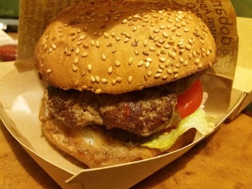
Burger vs Kebab
Hajducka 11, Chorzów
Restaurant
read more
674 m
Bar Kingii
Chorzów
Restaurant
read more
698 m
American BURGERS
Górnośląska 4, Chorzów
Restaurant
read more
720 m
Restauracja Metamorfoza
Ulica Katowicka 60/2, Chorzów
Restaurant
read more
729 m
Restauracja Cechowa
Dąbrowskiego 63, Chorzów
Restaurant
read more
730 m
Obiady jak u mamy
Wolności 83, Chorzów
Restaurant
read more
800 m
Gastrokebab
Hajducka 31, Chorzów
Restaurant
read more
848 m
Bar U Wąsacza
księdza Biskupa Bernarda Bogedaina 5, Chorzów
Restaurant
read more
848 m
Kebab Kaishen
Marii Konopnickiej, Chorzów
Restaurant
read more
854 m
Kebab u Rudej Gośki
3 Maja 48, Chorzów
Restaurant
read more
877 m
Grota Smaków
Różana 4, Chorzów
Restaurant
read more
912 m
Bajmix
Różana 18, Chorzów
Restaurant
read more
993 m
Plackarnia u Seby
Wolności 134, Chorzów
Restaurant
read more
1.153 km
Party Pizza
3 Maja 117, Chorzów
Restaurant
read more
📑
all categories
Accounting
Administrative area level 1
Administrative area level 2
Airport
Amusement park
Aquarium
Art gallery
Atm
Bakery
Bank
Bar
Beauty salon
Bicycle store
Book store
Bowling alley
Bus station
Cafe
Campground
Car dealer
Car rental
Car repair
Car wash
Casino
Cemetery
Church
City hall
Clothing store
Colloquial area
Convenience store
Courthouse
Dentist
Department store
Doctor
Electrician
Electronics store
Embassy
Finance
Fire station
Florist
Food
Funeral home
Furniture store
Gas station
General contractor
Grocery or supermarket
Gym
Hair care
Hardware store
Health
Hindu Temple
Home goods store
Hospital
Insurance agency
Intersection
Jewelry store
Laundry
Lawyer
Library
Light rail station
Liquor store
Local government office
Locality
Locksmith
Lodging
Meal delivery
Meal takeaway
Mosque
Movie rental
Movie theater
Moving company
Museum
Natural feature
Neighborhood
Night club
Painter
Park
Parking
Pet store
Pharmacy
Physiotherapist
Place of worship
Plumber
Point of interest
Police
Political
Post office
Premise
Real estate agency
Restaurant
Roofing contractor
Route
Rv park, camping
School
Shoe store
Shopping mall
Spa
Stadium
Storage
Store
Subpremise
Subway station
Supermarket
Synagogue
Taxi stand
Train station
Transit station
Travel agency
University
Veterinary care
Zoo
administrative area level 3
sublocality level 1
↑