Parking nearby Parking
Coronavirus disease (COVID-19) Situation
confirmed cases
6661991
deaths
120598
Poland
Parking nearby Parking
Parking
Strzelecka 49, Poznań Polska
contacts phone
:
+48
Latitude:
52.4000871
, Longitude:
16.9363958
read more
nearest Parking
442 m
Parking
Krakowska 27, Poznań
Parking
read more
491 m
Parking MAX
Droga Dębińska 10B, Poznań
Parking
read more
497 m
Parking
Zielona, Poznań
Parking
read more
507 m
Parking HEKTAR
Droga Dębińska 10B, Poznań
Parking
read more
508 m
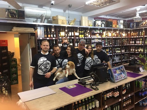
Regio Sfera Craft Beer & Wine
Garbary 26, Poznań
Parking
read more
611 m
Parking pod Kupcem Poznańskim
plac Wiosny Ludów 2, Poznań
Parking
read more
622 m
Parking Za Bramką
Za Bramką 13, Poznań
Parking
read more
634 m
Bolesława Krysiewicza 2 Parking
Krysiewicza 2, Poznań
Parking
read more
673 m
Parking ZDM - Dolna Wilda I
Olimpijska, Poznań
Parking
read more
700 m
AutoParking - pl. Wiosny Ludów
Szymańskiego 10, Poznań
Parking
read more
714 m
Aster. Dajksel-Grygiel M.
Garbary 44, Poznań
Parking
read more
716 m
Romana Szymańskiego 10 Parking
Szymańskiego 10, Poznań
Parking
read more
747 m
SAFE PARKING - 24h Fundacja Crossroads
Piekary 8A, Poznań
Parking
read more
747 m
SAFE PARKING - 24 Crossroads Foundation
Piekary 8A, Poznań
Parking
read more
749 m
Romana Szymańskiego 6 Parking
Szymańskiego 6, Poznań
Parking
read more
856 m
Piekary 22 Parking
Piekary 22, Poznań
Parking
read more
856 m
Parking
Piekary 2, Poznań
Parking
read more
863 m
AutoParking - Piekary
Piekary 1, Poznań
Parking
read more
903 m
parking 24h
Kórnicka 24, Poznań
Parking
read more
967 m
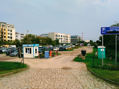
ZDM - Chwaliszewo
Poznań
Parking
read more
970 m
Dolina 18 Parking
Dolina 18, Poznań
Parking
read more
1.019 km
Powstańców Wielkopolskich 8-10 Parking
Powstańców Wielkopolskich 8-10, Poznań
Parking
read more
1.047 km
Parking dla osób niepełnosprawnych
Aleje Marcinkowskiego 9, Poznań
Parking
read more
1.126 km
Parking strzeżony
Taczaka 16, Poznań
Parking
read more
1.252 km
Kazimierza Kantaka 8/9 Parking
Kazimierza Kantaka 8/9, Poznań
Parking
read more
📑
all categories
Accounting
Administrative area level 1
Administrative area level 2
Airport
Amusement park
Aquarium
Art gallery
Atm
Bakery
Bank
Bar
Beauty salon
Bicycle store
Book store
Bowling alley
Bus station
Cafe
Campground
Car dealer
Car rental
Car repair
Car wash
Casino
Cemetery
Church
City hall
Clothing store
Colloquial area
Convenience store
Courthouse
Dentist
Department store
Doctor
Electrician
Electronics store
Embassy
Finance
Fire station
Florist
Food
Funeral home
Furniture store
Gas station
General contractor
Grocery or supermarket
Gym
Hair care
Hardware store
Health
Hindu Temple
Home goods store
Hospital
Insurance agency
Intersection
Jewelry store
Laundry
Lawyer
Library
Light rail station
Liquor store
Local government office
Locality
Locksmith
Lodging
Meal delivery
Meal takeaway
Mosque
Movie rental
Movie theater
Moving company
Museum
Natural feature
Neighborhood
Night club
Painter
Park
Parking
Pet store
Pharmacy
Physiotherapist
Place of worship
Plumber
Point of interest
Police
Political
Post office
Premise
Real estate agency
Restaurant
Roofing contractor
Route
Rv park, camping
School
Shoe store
Shopping mall
Spa
Stadium
Storage
Store
Subpremise
Subway station
Supermarket
Synagogue
Taxi stand
Train station
Transit station
Travel agency
University
Veterinary care
Zoo
administrative area level 3
sublocality level 1
↑