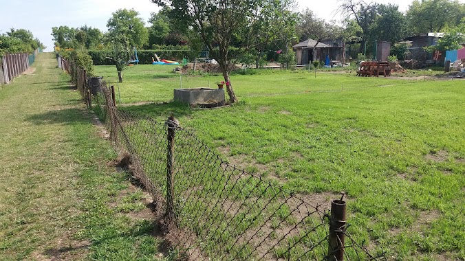
Park nearby Park Olimpijczyków
Coronavirus disease (COVID-19) Situation
confirmed cases
6661991
deaths
120598
Poland
Park nearby Park Olimpijczyków
Park Olimpijczyków
Wypoczynkowa, 40-959, Katowice, Katowice, PL Poland
contacts phone
:
+48
Latitude:
50.2603869
, Longitude:
19.0919353
larger map & directions
read more
nearest Park
114 m
skwer Janusza Sidły
Katowice
Park
read more
124 m
psi park
Unnamed Road, Katowice
Park
read more
492 m
skwer Walentego Roździeńskiego
Katowice
Park
read more
509 m
Skwer Walentego Rozdzieńskiego
Olchawy 3, Katowice
Park
read more
1.347 km
skwer Hilarego Krzysztofiaka
Katowice
Park
read more
1.554 km
Zespół przyrodniczo-krajobrazowy Szopienice-Borki
Sosnowiecka, Katowice
Park
read more
1.94 km
skwer Emila i Georga Zillmannów
Katowice
Park
read more
2.017 km
Ścieżka edukacyjna Kruszczyk szerokolistny w Lasku Stawiki w Sosnowcu
Sosnowiec
Park
read more
2.403 km
Skwer Rybka
Katowice
Park
read more
2.458 km
Park
Katowice
Park
read more
2.494 km
Park Kruczkowskiego
Kresowa, Sosnowiec
Park
read more
2.498 km
Wybieg dla psow
Myslowice
Park
read more
2.517 km
Park Kresowy
Marsz. Piłsudskiego 116, Sosnowiec
Park
read more
2.686 km
Dział Botaniczno-Zoologiczny - EGZOTARIUM MZUK
Marszałka Józefa Piłsudskiego 116, Sosnowiec
Park
read more
2.772 km
Park Tysiąclecia
Przygraniczna 94, Sosnowiec
Park
read more
2.803 km
Ogród Teatralna
Teatralna, Sosnowiec
Park
read more
2.968 km
Bratek
Katowice
Park
read more
2.99 km
Ogródki Działkowe Bratek
Katowice
Park
read more
3.043 km
Zielony Zakątek
Katowice
Park
read more
3.414 km
Boiska i plac zabaw
Jodłowa 1F, Mysłowice
Park
read more
3.734 km
Teren spacerowy
Pułaskiego, Katowice
Park
read more
4.248 km
Park Żeromskiego
Stefana Żeromskiego, Sosnowiec
Park
read more
4.25 km
Park Mini
Staropogońska 75, Sosnowiec
Park
read more
4.414 km
Former Evangelical-Augsburg Cemetery
Damrota, Katowice
Park
read more
5.768 km
Rodzinny Ogród Działkowy im. Stanisława Staszica w Sosnowcu
Sosnowiec
Park
read more
📑
all categories
Accounting
Administrative area level 1
Administrative area level 2
Airport
Amusement park
Aquarium
Art gallery
Atm
Bakery
Bank
Bar
Beauty salon
Bicycle store
Book store
Bowling alley
Bus station
Cafe
Campground
Car dealer
Car rental
Car repair
Car wash
Casino
Cemetery
Church
City hall
Clothing store
Colloquial area
Convenience store
Courthouse
Dentist
Department store
Doctor
Electrician
Electronics store
Embassy
Finance
Fire station
Florist
Food
Funeral home
Furniture store
Gas station
General contractor
Grocery or supermarket
Gym
Hair care
Hardware store
Health
Hindu Temple
Home goods store
Hospital
Insurance agency
Intersection
Jewelry store
Laundry
Lawyer
Library
Light rail station
Liquor store
Local government office
Locality
Locksmith
Lodging
Meal delivery
Meal takeaway
Mosque
Movie rental
Movie theater
Moving company
Museum
Natural feature
Neighborhood
Night club
Painter
Park
Parking
Pet store
Pharmacy
Physiotherapist
Place of worship
Plumber
Point of interest
Police
Political
Post office
Premise
Real estate agency
Restaurant
Roofing contractor
Route
Rv park, camping
School
Shoe store
Shopping mall
Spa
Stadium
Storage
Store
Subpremise
Subway station
Supermarket
Synagogue
Taxi stand
Train station
Transit station
Travel agency
University
Veterinary care
Zoo
administrative area level 3
sublocality level 1
↑