Gas station nearby Łęczyca Stacja Auto Gaz 24H
Poland
Gas station nearby Łęczyca Stacja Auto Gaz 24H
Łęczyca Stacja Auto Gaz 24H
Dworcowa 7, Łęczyca Polska
contacts phone
:
+48
Latitude:
52.3141427
, Longitude:
16.8801231
read more
nearest Gas station
1.208 km
Etta. PHU. Borowiak R.
Łęczycka 61, Wiry
Gas station
read more
2.807 km
Orlen
Sobieskiego 62, Luboń
Gas station
read more
2.807 km
Stacja Paliw ORLEN
Sobieskiego 62, Luboń
Gas station
read more
3.461 km
Lukasz
Kasprzaka 17, Luboń
Gas station
read more
3.782 km
Lotos
Armii Poznań 58, Luboń
Gas station
read more
3.782 km
LOTOS. Stacja paliw.
Armii Poznań 58, Luboń
Gas station
read more
4.059 km
Shell
Żabikowska 68, Luboń
Gas station
read more
4.124 km
Auto-Gaz. Stacja paliw
Poznańska 108, Puszczykowo
Gas station
read more
4.942 km
Stacja CNG
Głogowska 412, Poznań
Gas station
read more
5.25 km
Shell
28 Czerwca 1956 r. 419, Poznań
Gas station
read more
5.267 km
Stacja Paliw Auchan
Głogowska 432, Poznań
Gas station
read more
5.298 km
Prywatna
Zakładowa 1, Komorniki
Gas station
read more
5.361 km
Prywatna
Matowa, Komorniki
Gas station
read more
5.378 km
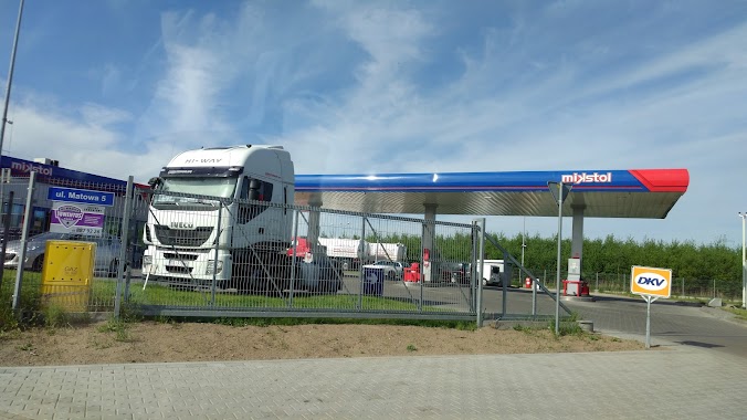
Stacja mikstol
5,, Matowa, Komorniki
Gas station
read more
6.768 km
Lex Retro Sp. z o.o.
Grzybowa 20, Poznań
Gas station
read more
7.134 km
Circle K
ul, Czechosłowacka 108, Poznań
Gas station
read more
7.696 km
Total Poznań Górecka
Górecka 25, Poznań
Gas station
read more
9.381 km
Stacja Paliw ORLEN
Bolesława Krzywoustego 121, Poznań
Gas station
read more
9.897 km
Circle K
ul, Bobrzańska 21, Poznań
Gas station
read more
10.311 km
BP
Rataje 61, Poznań
Gas station
read more
10.324 km
Greenway Polska
Szwedzka, Poznań
Gas station
read more
10.402 km
Stacja Paliw
Skórzewo
Gas station
read more
13.186 km
LPG - Przeźmierowo
Rynkowa 2, Przeźmierowo
Gas station
read more
13.402 km
Independent
Dąbrowskiego 381A, Poznań
Gas station
read more
13.928 km
Stacja Paliw ORLEN
(wlot) 231, Warszawska 61, Poznań
Gas station
read more
📑
all categories
Accounting
Administrative area level 1
Administrative area level 2
Airport
Amusement park
Aquarium
Art gallery
Atm
Bakery
Bank
Bar
Beauty salon
Bicycle store
Book store
Bowling alley
Bus station
Cafe
Campground
Car dealer
Car rental
Car repair
Car wash
Casino
Cemetery
Church
City hall
Clothing store
Colloquial area
Convenience store
Courthouse
Dentist
Department store
Doctor
Electrician
Electronics store
Embassy
Finance
Fire station
Florist
Food
Funeral home
Furniture store
Gas station
General contractor
Grocery or supermarket
Gym
Hair care
Hardware store
Health
Hindu Temple
Home goods store
Hospital
Insurance agency
Intersection
Jewelry store
Laundry
Lawyer
Library
Light rail station
Liquor store
Local government office
Locality
Locksmith
Lodging
Meal delivery
Meal takeaway
Mosque
Movie rental
Movie theater
Moving company
Museum
Natural feature
Neighborhood
Night club
Painter
Park
Parking
Pet store
Pharmacy
Physiotherapist
Place of worship
Plumber
Point of interest
Police
Political
Post office
Premise
Real estate agency
Restaurant
Roofing contractor
Route
Rv park, camping
School
Shoe store
Shopping mall
Spa
Stadium
Storage
Store
Subpremise
Subway station
Supermarket
Synagogue
Taxi stand
Train station
Transit station
Travel agency
University
Veterinary care
Zoo
administrative area level 3
sublocality level 1
↑