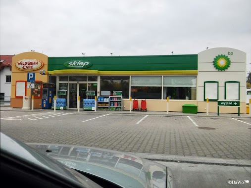
Gas station nearby BP
Coronavirus disease (COVID-19) Situation
confirmed cases
6661991
deaths
120598
Poland
Gas station nearby BP
BP
169-171, Rzgowska, 93-311, Łódź, Łódź, PL Polen
contacts phone
:
+48 722 162 826
website:
www.bp.com
Latitude:
51.7219931
, Longitude:
19.4828663
larger map & directions
read more
nearest Gas station
392 m
Statoil Rzgowska
Rzgowska 211, Łódź
Gas station
read more
398 m
Circle K
Rzgowska 211, Łódź
Gas station
read more
510 m
LPG
Rzgowska 93, Łódź
Gas station
read more
918 m
eMILA – Samoobsługowa
Rzgowska 4, Łódź
Gas station
read more
1.233 km
Stacja Paliw lpg
Trybunalska 14, Łódź
Gas station
read more
1.343 km
Carrefour
Rzgowska 242, Łódź
Gas station
read more
1.348 km
Stacja Paliw ORLEN
Rzgowska 66A, Łódź
Gas station
read more
1.348 km
Orlen
Rzgowska 66A, Łódź
Gas station
read more
1.348 km
rzgowska
Rzgowska 66A, Łódź
Gas station
read more
1.428 km
BP
Rzgowska 252, Łódź
Gas station
read more
1.495 km
AUTO GAZ
Kolumny 25, Łódź
Gas station
read more
1.867 km
Stacja Paliw ORLEN
Śmigłego-Rydza 43, Łódź
Gas station
read more
1.867 km
Orlen
Śmigłego-Rydza 43, Łódź
Gas station
read more
1.875 km
eMILA.
Dąbrowskiego 17/21, Łódź
Gas station
read more
1.882 km
Chlewicki Demokratyczna 117
Demokratyczna 117, Łódź
Gas station
read more
2.192 km
Shell
Gojawiczyńskiej 58, Łódź
Gas station
read more
2.194 km
Stacja benzynowa
Gojawiczyńskiej 19, Łódź
Gas station
read more
2.604 km
Milton Trustee Sp. z o.o.
Energetyków 7, Łódź
Gas station
read more
2.832 km
Circle K
Prądzyńskiego 1-3, Łódź
Gas station
read more
2.899 km
Interoil
Łęczycka 11/13, Łódź
Gas station
read more
2.932 km
Shell
Śmigłego-Rydza 23, Łódź
Gas station
read more
2.932 km
Shell
Śmigłego-Rydza, 23, Marszałka Edwarda, Łódź
Gas station
read more
2.934 km
Mkajskorupa
Łęczycka 11, Łódź
Gas station
read more
2.975 km
Petromax. PW. Kubiak R.
Słowiańska 1/9, Łódź
Gas station
read more
3.144 km
Orlen
Aleja Jana Pawła II 76, Łódź
Gas station
read more
📑
all categories
Accounting
Administrative area level 1
Administrative area level 2
Airport
Amusement park
Aquarium
Art gallery
Atm
Bakery
Bank
Bar
Beauty salon
Bicycle store
Book store
Bowling alley
Bus station
Cafe
Campground
Car dealer
Car rental
Car repair
Car wash
Casino
Cemetery
Church
City hall
Clothing store
Colloquial area
Convenience store
Courthouse
Dentist
Department store
Doctor
Electrician
Electronics store
Embassy
Finance
Fire station
Florist
Food
Funeral home
Furniture store
Gas station
General contractor
Grocery or supermarket
Gym
Hair care
Hardware store
Health
Hindu Temple
Home goods store
Hospital
Insurance agency
Intersection
Jewelry store
Laundry
Lawyer
Library
Light rail station
Liquor store
Local government office
Locality
Locksmith
Lodging
Meal delivery
Meal takeaway
Mosque
Movie rental
Movie theater
Moving company
Museum
Natural feature
Neighborhood
Night club
Painter
Park
Parking
Pet store
Pharmacy
Physiotherapist
Place of worship
Plumber
Point of interest
Police
Political
Post office
Premise
Real estate agency
Restaurant
Roofing contractor
Route
Rv park, camping
School
Shoe store
Shopping mall
Spa
Stadium
Storage
Store
Subpremise
Subway station
Supermarket
Synagogue
Taxi stand
Train station
Transit station
Travel agency
University
Veterinary care
Zoo
administrative area level 3
sublocality level 1
↑