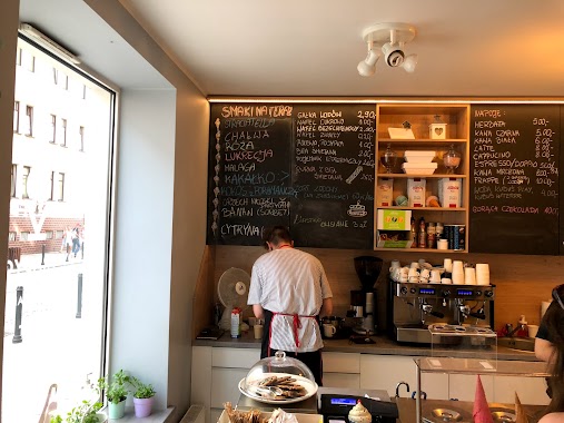
Cafe nearby Kurhaus
Coronavirus disease (COVID-19) Situation
confirmed cases
6661991
deaths
120598
Poland
Cafe nearby Kurhaus
Kurhaus
6, Aldony, 80-442, Gdańsk, Gdańsk, PL Poland
contacts phone
:
+48
website:
instagram.com
Latitude:
54.381964
, Longitude:
18.6125967
larger map & directions
read more
nearest Cafe
52 m
(do usunięcia)
7, Wajdeloty, Gdańsk
Cafe
read more
80 m
Traditional ice cream Kwaśniak 1954
Wajdeloty 1/2, Gdańsk
Cafe
read more
80 m
Lody Tradycyjne Kwaśniak 1954
Wajdeloty 1/2, Gdańsk
Cafe
read more
105 m
Fu by Fukafe & friends
Wajdeloty 22, Gdańsk
Cafe
read more
125 m
Motto Bistro Cafe
Wajdeloty 21, Gdańsk
Cafe
read more
171 m
Miód Melina Cafe & Bistro
Ludwika Waryńskiego 21, Gdańsk
Cafe
read more
252 m
Kawa na wynos
Czerwony Dwór, Gdańsk
Cafe
read more
414 m
Cristal Cafe w Galeria Metropolia
Jana Kilińskiego 4, Gdańsk
Cafe
read more
433 m
Fundacja Alegoria Kultury
Dmowskiego 10, Gdańsk
Cafe
read more
449 m
Graciarnia
Dmowskiego 15, Gdańsk
Cafe
read more
480 m
Fundacja Alegoria Kultury
Dmowskiego 3, Gdańsk
Cafe
read more
485 m
Second Cup nieczynne do odwołania
Jana Kilińskiego 4, Gdańsk
Cafe
read more
486 m
Czas na Herbatę
Jana Kilińskiego 4, Gdańsk
Cafe
read more
488 m
Piekarnia-Cukiernia Pellowski
Dmowskiego 16, Gdańsk
Cafe
read more
504 m
Loveat
Klonowa 4D, Gdańsk
Cafe
read more
572 m
COFFEESHOP
aleja Grunwaldzka 76/78, Gdańsk
Cafe
read more
584 m
Starbucks
CH Manhattan, al Grunwaldzka 82, Gdańsk
Cafe
read more
589 m
CafeOLIMP
aleja Grunwaldzka 92/98, Gdańsk
Cafe
read more
713 m
COSTA COFFEE
aleja Grunwaldzka 141, Gdańsk
Cafe
read more
771 m
Pellowski Piekarnia Cukiernia
Aleja Generała Józefa Hallera 133, Gdańsk
Cafe
read more
771 m
Grycan
Aleja Grunwaldzka 141, Gdańsk
Cafe
read more
846 m
Dom Czekolady
Wrzeszcz, Gdańsk
Cafe
read more
871 m
Starbucks
aleja Grunwaldzka 141, Gdańsk
Cafe
read more
906 m
Cukiernia Sowa
aleja Rzeczypospolitej 33, Gdańsk
Cafe
read more
1.278 km
Loveat
Trubadurów, Gdańsk
Cafe
read more
📑
all categories
Accounting
Administrative area level 1
Administrative area level 2
Airport
Amusement park
Aquarium
Art gallery
Atm
Bakery
Bank
Bar
Beauty salon
Bicycle store
Book store
Bowling alley
Bus station
Cafe
Campground
Car dealer
Car rental
Car repair
Car wash
Casino
Cemetery
Church
City hall
Clothing store
Colloquial area
Convenience store
Courthouse
Dentist
Department store
Doctor
Electrician
Electronics store
Embassy
Finance
Fire station
Florist
Food
Funeral home
Furniture store
Gas station
General contractor
Grocery or supermarket
Gym
Hair care
Hardware store
Health
Hindu Temple
Home goods store
Hospital
Insurance agency
Intersection
Jewelry store
Laundry
Lawyer
Library
Light rail station
Liquor store
Local government office
Locality
Locksmith
Lodging
Meal delivery
Meal takeaway
Mosque
Movie rental
Movie theater
Moving company
Museum
Natural feature
Neighborhood
Night club
Painter
Park
Parking
Pet store
Pharmacy
Physiotherapist
Place of worship
Plumber
Point of interest
Police
Political
Post office
Premise
Real estate agency
Restaurant
Roofing contractor
Route
Rv park, camping
School
Shoe store
Shopping mall
Spa
Stadium
Storage
Store
Subpremise
Subway station
Supermarket
Synagogue
Taxi stand
Train station
Transit station
Travel agency
University
Veterinary care
Zoo
administrative area level 3
sublocality level 1
↑