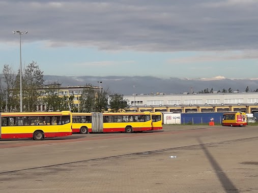
Bus station nearby Krzemieniecka - Ogród Botaniczny (4817)
Poland
Bus station nearby Krzemieniecka - Ogród Botaniczny (4817)
Krzemieniecka - Ogród Botaniczny (4817)
Poland Polen
contacts phone
:
+48
Latitude:
51.761929
, Longitude:
19.408766
read more
nearest Bus station
23 m
Krzemieniecka - Konstantynowska (0350)
Poland
Bus station
read more
423 m
Konstantynowska - ZOO (2080)
Poland
Bus station
read more
914 m
Krakowska - Michałowicza (0403)
Poland
Bus station
read more
979 m
Krakowska - Michałowicza (0407)
Poland
Bus station
read more
1.028 km
Unii Lubelskiej - Aquapark Fala (1580)
Poland
Bus station
read more
1.03 km
Krzemieniecka - Kowieńska (0412)
Poland
Bus station
read more
1.085 km
Unii Lubelskiej - Konstantynowska(Aquapark Fala) (1234)
Poland
Bus station
read more
1.093 km
Konstantynowska - Unii Lubelskiej(Aquapark Fala) (1239)
Poland
Bus station
read more
1.101 km
Krzemieniecka - Kowieńska (0415)
Poland
Bus station
read more
1.385 km
Bandurskiego - Atlas Arena (1773)
Poland
Bus station
read more
1.393 km
Srebrzyńska - Jarzynowa (1074)
Poland
Bus station
read more
1.629 km
Dw. Łódź Kaliska (1711)
Poland
Bus station
read more
1.659 km
Struga - Włókniarzy (1691)
Poland
Bus station
read more
1.707 km
Lodz dw.Kaliska
Poland
Bus station
read more
1.726 km
Karolewska - Włókniarzy (Dw. Ł. Kaliska) (2071)
Poland
Bus station
read more
1.8 km
Retkińska - Zagrodniki (0945)
Poland
Bus station
read more
1.847 km
Waltera-Janke - Bratysławska (0800)
Poland
Bus station
read more
1.851 km
Wyszyńskiego - Armii Krajowej (2087)
Poland
Bus station
read more
1.857 km
Karolewska - Włókniarzy (1690)
Poland
Bus station
read more
1.972 km
Spadochroniarzy - Biegunowa (0036)
Poland
Bus station
read more
1.996 km
Borowa - Siewna (0039)
Poland
Bus station
read more
2.035 km
Kopernika - Tobaco Park (1819)
Poland
Bus station
read more
2.251 km
Nowe Sady - zajezdnia MPK
Poland
Bus station
read more
2.351 km
Złotno - Podchorążych (1502)
Poland
Bus station
read more
2.353 km
Nowe Sady - zajezdnia NOWE SADY (9012)
Poland
Bus station
read more
📑
all categories
Accounting
Administrative area level 1
Administrative area level 2
Airport
Amusement park
Aquarium
Art gallery
Atm
Bakery
Bank
Bar
Beauty salon
Bicycle store
Book store
Bowling alley
Bus station
Cafe
Campground
Car dealer
Car rental
Car repair
Car wash
Casino
Cemetery
Church
City hall
Clothing store
Colloquial area
Convenience store
Courthouse
Dentist
Department store
Doctor
Electrician
Electronics store
Embassy
Finance
Fire station
Florist
Food
Funeral home
Furniture store
Gas station
General contractor
Grocery or supermarket
Gym
Hair care
Hardware store
Health
Hindu Temple
Home goods store
Hospital
Insurance agency
Intersection
Jewelry store
Laundry
Lawyer
Library
Light rail station
Liquor store
Local government office
Locality
Locksmith
Lodging
Meal delivery
Meal takeaway
Mosque
Movie rental
Movie theater
Moving company
Museum
Natural feature
Neighborhood
Night club
Painter
Park
Parking
Pet store
Pharmacy
Physiotherapist
Place of worship
Plumber
Point of interest
Police
Political
Post office
Premise
Real estate agency
Restaurant
Roofing contractor
Route
Rv park, camping
School
Shoe store
Shopping mall
Spa
Stadium
Storage
Store
Subpremise
Subway station
Supermarket
Synagogue
Taxi stand
Train station
Transit station
Travel agency
University
Veterinary care
Zoo
administrative area level 3
sublocality level 1
↑