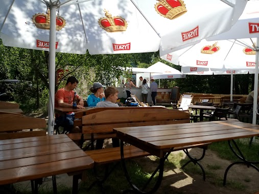
Bar nearby The Cumin Club
Coronavirus disease (COVID-19) Situation
confirmed cases
6661991
deaths
120598
Poland
Bar nearby The Cumin Club
The Cumin Club
15/ U6, Ul, Franciszka Klimczaka, Warszawa Polska
contacts phone
:
+48
Latitude:
52.1609438
, Longitude:
21.0746654
read more
nearest Bar
454 m
The Beer Store WILANÓW
Aleja Rzeczypospolitej 14, Warszawa
Bar
read more
474 m
Top Estetic
Adama Branickiego 12, Warszawa
Bar
read more
844 m
Sfera Burgera
Aleja Rzeczypospolitej 31a, Warszawa
Bar
read more
893 m
Sfera Burgera
Aleja Rzeczypospolitej 31D, Warszawa
Bar
read more
928 m
Pub Złoty Król
Stanisława Kostki Potockiego 27, Warszawa
Bar
read more
938 m
TASTE Burger
Przyczółkowa 400, Warszawa
Bar
read more
1.019 km
Kebab Ksanto
Przyczółkowa 317, Warszawa
Bar
read more
1.1 km
Kebab Ksanto
Wiertnicza 35, Warszawa
Bar
read more
1.3 km
Sokołyk Złota
Złota 59, Warszawa
Bar
read more
1.315 km
Bar Pod Świerkami
Przyczółkowa 294, Warszawa
Bar
read more
1.458 km
Bar Orientalny CON HO
Stanisława Lentza 2A, Warszawa
Bar
read more
1.851 km
"Domowy Zakatek " Bistro&Pizzeria
Jana Rosoła 48
Bar
read more
1.897 km
New Vegas
Rodziny Ulmów 14, Warszawa
Bar
read more
2.269 km
KEN54 Klubokawiarnia
Aleja Komisji Edukacji Narodowej 54/lokal U1, Warszawa
Bar
read more
2.442 km
Winners Sports Bar Ursynow
Aleja Komisji Edukacji Narodowej 49, Warszawa
Bar
read more
2.536 km
Ankara Kebab
Jastrzębowskiego 24, Warszawa
Bar
read more
2.667 km
Kebab Hak An
Jastrzębowskiego 4A, Warszawa
Bar
read more
2.698 km
Kim Son
Miklaszewskiego 4, Warszawa
Bar
read more
2.808 km
Malish Restaurant & Shisha Bar
Dereniowa 2, Warszawa
Bar
read more
2.816 km
Dżungla
Dereniowa 2, Warszawa
Bar
read more
2.902 km
Bar Thang Loi II
Dereniowa 3A, Warszawa
Bar
read more
3.206 km
Jaskinia Daniela
Spalska 4, Warszawa
Bar
read more
3.259 km
Bufet-Kawiarnia
Wilhelma Konrada Roentgena 5, Warszawa
Bar
read more
3.639 km
Stegny Bistro
Unnamed Road
Bar
read more
3.702 km
Bar Pod Kazurką
Perkalowa 10, Warszawa
Bar
read more
📑
all categories
Accounting
Administrative area level 1
Administrative area level 2
Airport
Amusement park
Aquarium
Art gallery
Atm
Bakery
Bank
Bar
Beauty salon
Bicycle store
Book store
Bowling alley
Bus station
Cafe
Campground
Car dealer
Car rental
Car repair
Car wash
Casino
Cemetery
Church
City hall
Clothing store
Colloquial area
Convenience store
Courthouse
Dentist
Department store
Doctor
Electrician
Electronics store
Embassy
Finance
Fire station
Florist
Food
Funeral home
Furniture store
Gas station
General contractor
Grocery or supermarket
Gym
Hair care
Hardware store
Health
Hindu Temple
Home goods store
Hospital
Insurance agency
Intersection
Jewelry store
Laundry
Lawyer
Library
Light rail station
Liquor store
Local government office
Locality
Locksmith
Lodging
Meal delivery
Meal takeaway
Mosque
Movie rental
Movie theater
Moving company
Museum
Natural feature
Neighborhood
Night club
Painter
Park
Parking
Pet store
Pharmacy
Physiotherapist
Place of worship
Plumber
Point of interest
Police
Political
Post office
Premise
Real estate agency
Restaurant
Roofing contractor
Route
Rv park, camping
School
Shoe store
Shopping mall
Spa
Stadium
Storage
Store
Subpremise
Subway station
Supermarket
Synagogue
Taxi stand
Train station
Transit station
Travel agency
University
Veterinary care
Zoo
administrative area level 3
sublocality level 1
↑