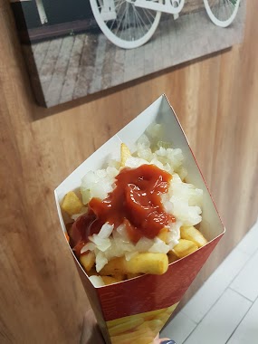
Bar nearby Latający Holender Frytki
Coronavirus disease (COVID-19) Situation
confirmed cases
6661991
deaths
120598
Poland
Bar nearby Latający Holender Frytki
Latający Holender Frytki
52, Piotra Stachiewicza, 30-001, Kraków, Kraków, PL Polska
contacts phone
:
+48 795 122 008
Latitude:
50.0874425
, Longitude:
19.9166927
larger map & directions
read more
nearest Bar
510 m
Kuchnia Brawaty
Piotra Wysockiego, Kraków
Bar
read more
693 m
Jadłodajnia Mała Chatka
Nad Sudołem 6, Kraków
Bar
read more
774 m
MARLIN - Sklep Rybny & Smażalnia
Krowoderskich Zuchów 21A, Kraków
Bar
read more
780 m
Pub Drewutnia
Władysława Łokietka 43, Kraków
Bar
read more
787 m
Marlin Smazalnia
Krowoderskich Zuchów 21, Kraków
Bar
read more
882 m
U Taty. Bar
20A, Bolesława Czerwieńskiego, Kraków
Bar
read more
1.275 km
GMT - Georgian Wine&Art Gallery
Bytomska 23, Kraków
Bar
read more
1.485 km
Prima Rolls - Lody Tajskie
Stawowa 55, Kraków
Bar
read more
1.493 km
Fresh Soki
Stawowa 55, Kraków
Bar
read more
1.594 km
Bar Pizza 51
Kazimierza Wielkiego 51, Kraków
Bar
read more
1.613 km
Knajpka
Kazimierza Wielkiego 51, Kraków
Bar
read more
1.623 km
Królewski. Bar
Królewska 88, Kraków
Bar
read more
1.817 km
Bar Kuchnia Polska
Gabrieli Zapolskiej 24, Kraków
Bar
read more
1.817 km
Bar Palce Lizać
Gabrieli Zapolskiej 24, Kraków
Bar
read more
1.838 km
Mlekomat od Bonifratrów
Lea 22, Kraków
Bar
read more
1.847 km
U Szwagra Alkohole
Juliusza Lea 26, Kraków
Bar
read more
1.91 km
PnP
33-332, Piastowska 51, Kraków
Bar
read more
1.967 km
Bar u Marii
Feliksa Konecznego 13, Kraków
Bar
read more
1.978 km
Whisky Bar EGON
Urzędnicza 26, Kraków
Bar
read more
2.185 km
Piwnica
Montelupich 3, Kraków
Bar
read more
2.206 km
Polishfood
Juliusza Lea 124, Kraków
Bar
read more
2.365 km
Punkt gastronomiczny
Pędzichów 27, Kraków
Bar
read more
2.405 km
Football Burger
Kraków
Bar
read more
2.423 km
Klub Dziekanat
Pędzichów 23, Kraków
Bar
read more
2.758 km
Polibuda Pub
Warszawska 17, Kraków
Bar
read more
📑
all categories
Accounting
Administrative area level 1
Administrative area level 2
Airport
Amusement park
Aquarium
Art gallery
Atm
Bakery
Bank
Bar
Beauty salon
Bicycle store
Book store
Bowling alley
Bus station
Cafe
Campground
Car dealer
Car rental
Car repair
Car wash
Casino
Cemetery
Church
City hall
Clothing store
Colloquial area
Convenience store
Courthouse
Dentist
Department store
Doctor
Electrician
Electronics store
Embassy
Finance
Fire station
Florist
Food
Funeral home
Furniture store
Gas station
General contractor
Grocery or supermarket
Gym
Hair care
Hardware store
Health
Hindu Temple
Home goods store
Hospital
Insurance agency
Intersection
Jewelry store
Laundry
Lawyer
Library
Light rail station
Liquor store
Local government office
Locality
Locksmith
Lodging
Meal delivery
Meal takeaway
Mosque
Movie rental
Movie theater
Moving company
Museum
Natural feature
Neighborhood
Night club
Painter
Park
Parking
Pet store
Pharmacy
Physiotherapist
Place of worship
Plumber
Point of interest
Police
Political
Post office
Premise
Real estate agency
Restaurant
Roofing contractor
Route
Rv park, camping
School
Shoe store
Shopping mall
Spa
Stadium
Storage
Store
Subpremise
Subway station
Supermarket
Synagogue
Taxi stand
Train station
Transit station
Travel agency
University
Veterinary care
Zoo
administrative area level 3
sublocality level 1
↑