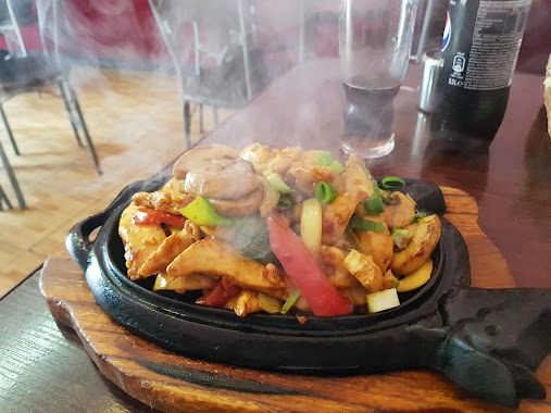
Bar nearby Fast Food
Coronavirus disease (COVID-19) Situation
confirmed cases
6661991
deaths
120598
Poland
Bar nearby Fast Food
Fast Food
30-001 Kraków, Polska
contacts phone
:
+48
Latitude:
50.0623186
, Longitude:
19.9604899
larger map & directions
read more
nearest Bar
79 m
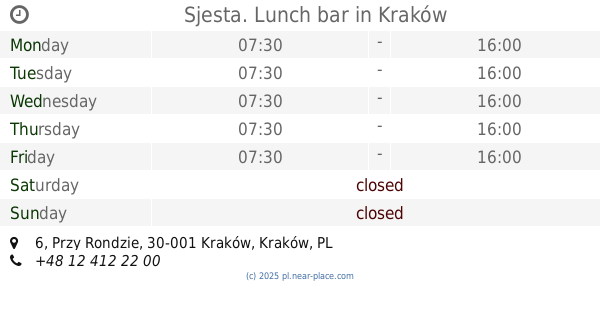
Sjesta. Lunch bar
Przy Rondzie 6, Kraków
Bar
read more
106 m
Lunch Bar Szczypta Smaku
Kazimierza Kordylewskiego 11, Kraków
Bar
read more
391 m
Kafeteria Mario
Jana i Jędrzeja Śniadeckich 10, Kraków
Bar
read more
489 m
Bartuś. PHU
Mogilska 25, Kraków
Bar
read more
537 m
Falafel
Grzegórzecka 44, Kraków
Bar
read more
547 m
W Cieniu Szkieletora
Iwony Borowickiej 9, Kraków
Bar
read more
577 m
Schizofrenia Café
Topolowa 42, Kraków
Bar
read more
589 m
Cue Bar Snooker & Bilard
Mogilska 35, Kraków
Bar
read more
619 m
Smakosz. Milk bar
Mogilska 58, Kraków
Bar
read more
619 m
Smakosz. Bar mleczny
Mogilska 58, Kraków
Bar
read more
658 m
Bar LAM HONG
Mogilska 43B, Kraków
Bar
read more
658 m
LAM HONG bar
Mogilska 43B, Kraków
Bar
read more
727 m
Pod 17. Bar
Grzegórzecka 17, Kraków
Bar
read more
783 m
Sport Bar
Rakowicka 17, Kraków
Bar
read more
922 m
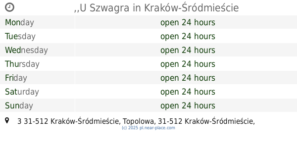
,,U Szwagra
Topolowa 3 31-512 Kraków-Śródmieście, Kraków-Śródmieście
Bar
read more
966 m
Krakowski Kumpir
Grzegórzecka 3/29, Kraków
Bar
read more
1.033 km
The G spot
Bonerowska 9, Kraków
Bar
read more
1.344 km
PUB Pod Ziemią - ROCKowa piwnica na Kazimierzu
Miodowa 43, Kraków
Bar
read more
1.347 km
Bar A Vodka
Mikołajska 5, Kraków
Bar
read more
1.361 km
Bar A Bierre Sous Arbres
Stare Miasto, Kraków
Bar
read more
1.61 km
Billiard Club PIK
Estery 18, Kraków
Bar
read more
1.614 km
BarOko
plac Nowy 4, Kraków
Bar
read more
1.739 km
New day blues pub
Bożego Ciała 9, Kraków
Bar
read more
1.862 km
Підкова Бар
plac Wolnica 9, Kraków
Bar
read more
1.875 km
Ursa Maior Craft Beer Pub & Concept Store
plac Wolnica 10, Kraków
Bar
read more
📑
all categories
Accounting
Administrative area level 1
Administrative area level 2
Airport
Amusement park
Aquarium
Art gallery
Atm
Bakery
Bank
Bar
Beauty salon
Bicycle store
Book store
Bowling alley
Bus station
Cafe
Campground
Car dealer
Car rental
Car repair
Car wash
Casino
Cemetery
Church
City hall
Clothing store
Colloquial area
Convenience store
Courthouse
Dentist
Department store
Doctor
Electrician
Electronics store
Embassy
Finance
Fire station
Florist
Food
Funeral home
Furniture store
Gas station
General contractor
Grocery or supermarket
Gym
Hair care
Hardware store
Health
Hindu Temple
Home goods store
Hospital
Insurance agency
Intersection
Jewelry store
Laundry
Lawyer
Library
Light rail station
Liquor store
Local government office
Locality
Locksmith
Lodging
Meal delivery
Meal takeaway
Mosque
Movie rental
Movie theater
Moving company
Museum
Natural feature
Neighborhood
Night club
Painter
Park
Parking
Pet store
Pharmacy
Physiotherapist
Place of worship
Plumber
Point of interest
Police
Political
Post office
Premise
Real estate agency
Restaurant
Roofing contractor
Route
Rv park, camping
School
Shoe store
Shopping mall
Spa
Stadium
Storage
Store
Subpremise
Subway station
Supermarket
Synagogue
Taxi stand
Train station
Transit station
Travel agency
University
Veterinary care
Zoo
administrative area level 3
sublocality level 1
↑