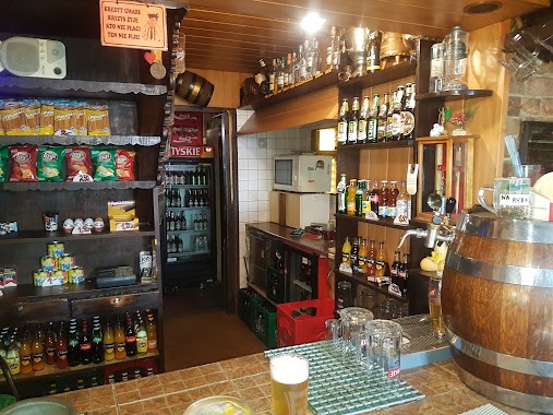
Bar nearby Amigo
Coronavirus disease (COVID-19) Situation
confirmed cases
6661991
deaths
120598
Poland
Bar nearby Amigo
Amigo
26, Cypriana Kamila Norwida, 41-700, Ruda Śląska, Ruda Śląska, PL Polska
contacts phone
:
+48
Latitude:
50.3083776
, Longitude:
18.8578398
larger map & directions
read more
nearest Bar
653 m
Smakowita przystań
Antoniego Sieronia 1, Ruda Śląska
Bar
read more
655 m
EX PUB
Bankowa 36A, Ruda Śląska
Bar
read more
791 m
U Gienka
Wolności 5, Ruda Śląska
Bar
read more
1.053 km
Wrzos
Chryzantem 21, Ruda Śląska
Bar
read more
1.363 km
Pub Borys
Fiołków 3, Ruda Śląska
Bar
read more
1.611 km
Oberża przy Kominku. Piwiarnia
Królowej Jadwigi 3, Ruda Śląska
Bar
read more
1.824 km
Bar Jarosz
Joanny 14, Ruda Śląska
Bar
read more
1.927 km
Pub Familia
Przedszkolna 6, Ruda Śląska
Bar
read more
1.929 km
Juliacz
Księdza Pawła Janika 28, Zabrze
Bar
read more
2.062 km
Pub Grota
712, plac Niepodległości 5-6, Ruda Śląska
Bar
read more
2.318 km
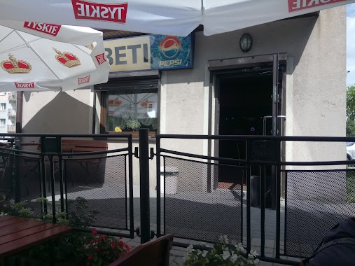
Beti
Latki 1, Ruda Śląska
Bar
read more
2.571 km
Bar Elbar
Zielińskiego 8, Ruda Śląska
Bar
read more
2.727 km
Bar Kebab
Bytomska 100, Zabrze
Bar
read more
2.808 km
Mr Hamburger
Niedurnego 38B, Ruda Śląska
Bar
read more
3.004 km
Knefel
Czarnoleśna, Ruda Śląska
Bar
read more
3.043 km
Bar Wiejski
Korczoka 33, Zabrze
Bar
read more
3.148 km
Wieża. Bar piwny
Jana Furgoła 2, Ruda Śląska
Bar
read more
3.96 km
La Mirage s.c. Pub. Greif M.A.
Frycza-Modrzewskiego 10, Bytom
Bar
read more
3.986 km
Bar Myszka
Zabrzańska, Bytom
Bar
read more
4.054 km
BAR
Sienkiewicza 10A, Ruda Śląska
Bar
read more
4.785 km
bistro przy kachloku
24 Ks, Potyki, Ruda Śląska
Bar
read more
4.794 km
Lody Świderki
Unnamed Road, Świętochłowice
Bar
read more
5.288 km
Kebab Pat Mar
Katowicka 31C, Świętochłowice
Bar
read more
6.446 km
Piątek Jerzy. Pub
Rycerska 7, Bytom
Bar
read more
6.47 km
bajzel
Rycerska 17, Bytom
Bar
read more
📑
all categories
Accounting
Administrative area level 1
Administrative area level 2
Airport
Amusement park
Aquarium
Art gallery
Atm
Bakery
Bank
Bar
Beauty salon
Bicycle store
Book store
Bowling alley
Bus station
Cafe
Campground
Car dealer
Car rental
Car repair
Car wash
Casino
Cemetery
Church
City hall
Clothing store
Colloquial area
Convenience store
Courthouse
Dentist
Department store
Doctor
Electrician
Electronics store
Embassy
Finance
Fire station
Florist
Food
Funeral home
Furniture store
Gas station
General contractor
Grocery or supermarket
Gym
Hair care
Hardware store
Health
Hindu Temple
Home goods store
Hospital
Insurance agency
Intersection
Jewelry store
Laundry
Lawyer
Library
Light rail station
Liquor store
Local government office
Locality
Locksmith
Lodging
Meal delivery
Meal takeaway
Mosque
Movie rental
Movie theater
Moving company
Museum
Natural feature
Neighborhood
Night club
Painter
Park
Parking
Pet store
Pharmacy
Physiotherapist
Place of worship
Plumber
Point of interest
Police
Political
Post office
Premise
Real estate agency
Restaurant
Roofing contractor
Route
Rv park, camping
School
Shoe store
Shopping mall
Spa
Stadium
Storage
Store
Subpremise
Subway station
Supermarket
Synagogue
Taxi stand
Train station
Transit station
Travel agency
University
Veterinary care
Zoo
administrative area level 3
sublocality level 1
↑